Space & Technology
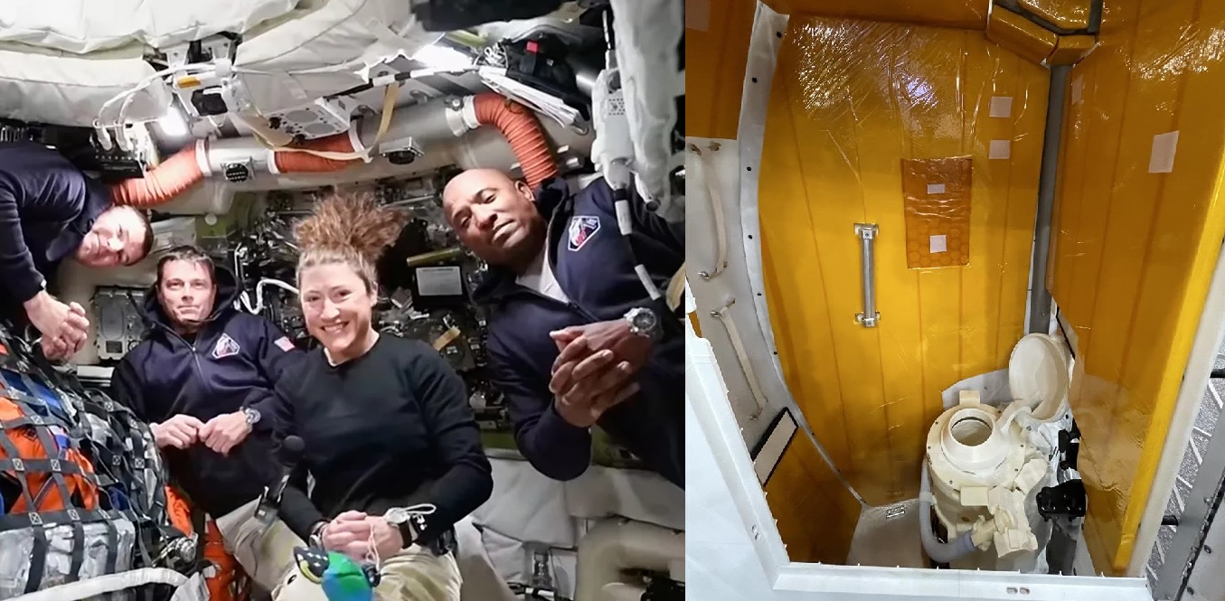
HOUSTON, — April 5, 2026 : The four astronauts aboard NASA’s Artemis II mission have crossed the halfway point of their journey to the Moon, as the Orion spacecraft continues outbound toward a scheduled lunar flyby on Monday, April 6, 2026. The mission, which launched on April 1, 2026, from Kennedy Space Center in Florida, marks the first crewed flight beyond low Earth orbit since Apollo 17 in 1972, ending a gap of more than 53 years. The crew—Commander Reid Wiseman, Pilot Victor Glover, Mission Specialist Christina Koch, and Canadian Space Agency astronaut Jeremy Hansen—is conducting system checks and observations during the transit. The spacecraft is expected to travel more than 252,000 miles (approximately 406,000 kilometers) from Earth, surpassing the human spaceflight distance record set by Apollo 13 in 1970. Mid-Mission Operations and Flight Milestones As Orion approaches the Moon, the crew is preparing to execute a lunar fly-around trajectory rather than entering orbit. The spacecraft will pass approximately 4,000 miles (6,400 kilometers) beyond the lunar surface and capture imagery of the Moon’s far side before performing a return trajectory to Earth. Pilot Victor Glover reported during a transmission that Earth is now visibly distant, stating that “the Earth is quite small, and the Moon is definitely getting bigger.” The astronauts have also captured imagery of Earth during the outbound phase. The Artemis II crew includes several historic firsts: Christina Koch is the first woman assigned to a lunar mission, Victor Glover is the first Black astronaut on a lunar trajectory, and Jeremy Hansen is the first non-U.S. astronaut to participate in a Moon-bound mission. Waste Management System Malfunction During transit, engineers and crew have been addressing a recurring issue with Orion’s Universal Waste Management System. The spacecraft’s toilet, responsible for venting liquid waste and storing solid waste, has experienced intermittent malfunctions since shortly after launch. Mission controllers identified a suspected ice blockage in the wastewater vent line, which prevented proper venting of urine overboard. Artemis II Flight Director Judd Frieling confirmed that attempts to vent the wastewater tank overnight between April 4 and April 5 were unsuccessful due to the blockage. As a contingency, astronauts have been directed to use collapsible urine collection devices, similar to procedures employed earlier in the mission on flight day one. Engineers instructed the crew to reorient the spacecraft to expose the affected vent line to solar radiation. This maneuver partially resolved the issue, allowing approximately half of the accumulated liquid waste to be vented. The toilet system remains operational for solid waste but is not functioning at full capacity. NASA continues to monitor and troubleshoot the issue. Debbie Korth, Orion program deputy manager, stated that astronauts also reported an odor originating from the bathroom compartment, which is located in the floor of the capsule and enclosed by a door and curtain. She noted that waste management systems have historically posed engineering challenges, including during the Space Shuttle program. John Honeycutt, chair of the Artemis II mission management team, said the crew’s safety is not affected and emphasized that astronauts trained for such contingencies. He stated that the spacecraft remains in a stable condition, though efforts are ongoing to restore full toilet functionality. Additional Technical Issues In addition to the waste system problem, the crew previously resolved an early mission issue involving the toilet pump, which was attributed to insufficient water priming shortly after liftoff on April 1. That issue was corrected without further impact. NASA also confirmed that one of the crew’s onboard laptop computers has become non-operational. The astronauts are continuing mission activities using the remaining three functional laptops. International Participation and Mission Timeline The Canadian Space Agency (CSA) highlighted Jeremy Hansen’s participation as a milestone for international collaboration. CSA President Lisa Campbell, speaking from Quebec, stated that Hansen’s role reflects Canada’s contribution to human space exploration. Hansen has reported observing “extraordinary” views from Orion during the journey. The Artemis II mission is scheduled to conclude with a Pacific Ocean splashdown off the coast of San Diego on April 10, 2026, completing a flight duration of approximately 10 days. Program Objectives and Future Plans Artemis II serves as a crewed test flight of NASA’s Orion spacecraft and Space Launch System (SLS) rocket, validating systems required for future lunar missions. The mission does not include a landing but is designed to certify hardware and operational procedures. NASA’s Artemis program aims to conduct a crewed lunar landing near the Moon’s south pole by 2028, as part of a broader objective to establish a sustained human presence on the lunar surface. Aside from the ongoing waste management system issue, mission operations are proceeding as planned, with astronauts continuing scheduled activities and system evaluations during the outbound phase toward the Moon.
Read More → Posted on 2026-04-05 17:08:22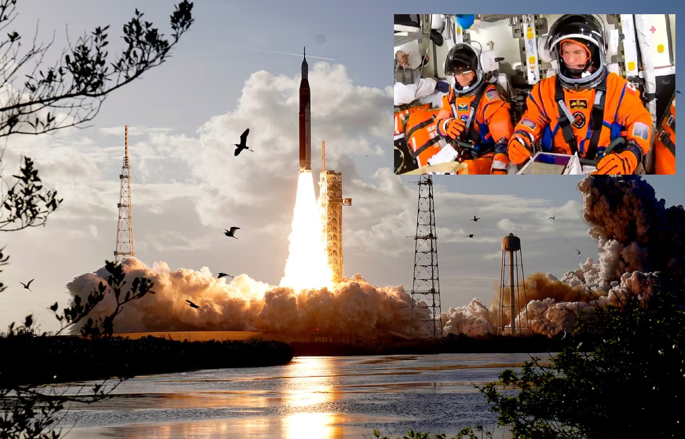
Space & Technology
KENNEDY SPACE CENTER, — Florida, April 2, 2026 : NASA has successfully launched the Artemis II mission, sending four astronauts aboard the Orion spacecraft toward the Moon in the first crewed mission to lunar vicinity since the Apollo 17 mission in 1972. The launch took place at 6:35 p.m. Eastern Time on April 1 from Launch Complex 39B at Kennedy Space Center. The Orion spacecraft, manufactured by Lockheed Martin, lifted off atop the Space Launch System (SLS), a 322-foot rocket generating approximately 8.8 million pounds of thrust using twin solid rocket boosters and four RS-25 engines. Shortly after liftoff, both the solid rocket boosters and the launch abort system separated as planned. The spacecraft, named “Integrity”, is carrying NASA astronauts Reid Wiseman as commander, Victor Glover as pilot, and Christina Koch as mission specialist, along with Jeremy Hansen of the Canadian Space Agency serving as mission specialist. Mission Profile and Trajectory The Artemis II mission is planned as a 10-day flight covering approximately 685,000 miles. The mission begins with two Earth orbits to evaluate spacecraft systems before executing a translunar injection maneuver. The spacecraft will then travel nearly 250,000 miles from Earth and approximately 5,000 miles beyond the far side of the Moon. Orion will follow a free-return trajectory, using the Moon’s gravitational field to loop around the lunar far side and return toward Earth without requiring major propulsion maneuvers for the return leg. Spacecraft Systems and Capabilities The Orion spacecraft used for Artemis II incorporates multiple systems designed for sustained human operations in deep space. These include an advanced Environmental Control and Life Support System (ECLSS), updated flight displays and control interfaces, and a fully operational launch abort system designed to ensure crew safety during ascent. The spacecraft interior is equipped with facilities to support extended missions, including an exercise machine, potable water supply, a galley, and a waste management and hygiene bay. Communication systems onboard include standard audio communication links and an experimental laser-based system, the Orion Artemis II Optical Communications System, designed to provide high-bandwidth data transmission with mission control in Houston. The European Service Module, which provides propulsion, power, and thermal control, was supplied by Airbus Defence and Space. The launch abort system includes components from multiple suppliers, including abort motor contributions from Northrop Grumman. In-Flight Operations and Testing During the mission, the crew will conduct a series of system tests and operational demonstrations aimed at validating Orion’s readiness for future deep space missions. These activities include proximity maneuvering operations and direct observation of the Moon’s far side. The mission will also collect baseline data on spacecraft performance and human health in a deep space environment beyond low-Earth orbit. These data are intended to support planning for subsequent Artemis missions, including crewed lunar landings. Re-entry and Recovery Operations At the conclusion of the mission, scheduled for April 10, the Orion spacecraft will re-enter Earth’s atmosphere at speeds reaching up to 30 times the speed of sound. Atmospheric drag and a parachute deployment sequence will reduce velocity to under 20 miles per hour before splashdown in the Pacific Ocean off the coast of San Diego, California. Recovery operations will involve NASA teams, contractors, and U.S. Navy personnel positioned in the designated landing zone. Industry and Program Statements Robert Lightfoot, president of Lockheed Martin Space, stated that the mission will focus on testing Orion systems and demonstrating its capability to transport crews to the lunar surface and return them safely. Kirk Shireman, vice president and Orion program manager at Lockheed Martin Space, said the mission reflects years of development work and is intended to prepare for future crewed flights beyond Earth orbit. Program Context Artemis II is the first crewed flight of both the Orion spacecraft and the Space Launch System rocket. The mission builds on uncrewed test flights and is a key step in NASA’s Artemis program, which aims to return humans to the Moon and establish a sustained presence in lunar orbit and on the surface. Data gathered during Artemis II will be used to refine mission systems and procedures for upcoming missions, including those involving crewed lunar landings.
Read More → Posted on 2026-04-02 16:44:28
Space & Technology
TOMSK, Russia — March 31, 2026 : Researchers at Tomsk Polytechnic University have initiated pilot-scale production of miniature nuclear batteries based on betavoltaic technology, marking a step forward in long-duration energy systems for medical and specialized technological applications. The development is being carried out in parallel with smart interface technologies, including systems designed to support mind-controlled prosthetic devices. The university confirmed that the current pilot batch represents an early-stage production effort, with plans to expand output in the coming year to meet expected demand for reliable, maintenance-free power sources in niche sectors. Technology Overview and Working Principle The newly developed batteries operate on the principle of betavoltaics, a method that converts radiation from radioactive decay directly into electricity. The core energy source is Nickel-63, an artificially produced isotope that undergoes beta decay. As Nickel-63 decays, it emits low-energy beta particles (electrons). These particles interact with a semiconductor converter—constructed using materials such as silicon or diamond microchannel structures—generating electron-hole pairs. This interaction produces a continuous electric current without the need for chemical reactions or recharging. Nickel-63 has a half-life of approximately 100 years, enabling the battery to provide a stable energy output for up to 50 years or more. The system is designed as a layered structure, where thin films of the isotope (around two microns thick) are combined with semiconductor diodes. Earlier prototypes developed in Russia incorporated Schottky barrier diamond diodes (about 10 microns thick), arranged in stacked configurations alongside nickel foil. Alternative designs have used silicon p-i-n semiconductor structures or electroplated Nickel-63 layers. The isotope itself is produced by irradiating nickel-62 in a nuclear reactor, followed by an enrichment process. Previous project frameworks have identified the IRT-T research reactor at Tomsk Polytechnic University as a potential production source. Size, Efficiency, and Safety Characteristics The architectural design of the betavoltaic cell enables a compact form factor, with the battery being approximately 30 times smaller than conventional lithium-ion batteries while maintaining a high energy density relative to its volume. Despite being described as a “nuclear” battery, the system is classified as safe for close-proximity use. The beta radiation emitted by Nickel-63 is low in energy and does not include gamma radiation, meaning it lacks significant penetration capability. All emitted radiation is fully absorbed within the battery’s internal structure and encapsulated housing, preventing external exposure or environmental contamination. Performance metrics from earlier research indicate power densities of approximately 10 microwatts per cubic centimeter, suitable for low-power electronic devices. Specific energy levels in optimized designs have reached around 3,300 milliwatt-hours per gram, which is significantly higher than conventional electrochemical batteries of comparable size. Applications in Medicine, Space, and Remote Systems The primary focus of the current pilot batch is the healthcare sector. The batteries are intended to power advanced medical implants, including neurological devices, cardiac pacemakers, and bio-stimulants. Their long operational life and reliability make them particularly suitable for integration into mind-controlled prosthetic systems, where uninterrupted power supply is critical for neural interface functionality. Beyond medical use, the technology is applicable in aerospace and remote infrastructure. Potential deployments include powering microelectronics in satellites and deep-space missions, as well as autonomous sensors operating in extreme environments such as Arctic regions or deep-water monitoring systems, where routine maintenance or battery replacement is not feasible. Cost Constraints and Production Challenges A significant limitation affecting large-scale commercialization is the high cost of producing Nickel-63. The isotope does not occur naturally and must be manufactured through a multi-stage process, involving isotope separation via centrifugation followed by irradiation in a nuclear reactor. Due to this complex production chain, the cost of Nickel-63 is estimated at approximately $4,000 per gram. While researchers have optimized semiconductor components to reduce overall system costs, the expense of the radioactive material remains a key barrier to broader adoption beyond specialized applications. Future Development and Scaling Plans The pilot production phase is intended to validate manufacturing processes and performance characteristics under practical conditions. Researchers at Tomsk Polytechnic University plan to focus next on improving conversion efficiency, refining battery architecture, and exploring methods to scale production. The development builds on longstanding Russian research into Nickel-63-based betavoltaic systems and aligns with efforts to create long-duration power solutions for environments where conventional batteries are impractical. Further technical specifications for the current pilot batch have not yet been disclosed.
Read More → Posted on 2026-03-31 16:42:43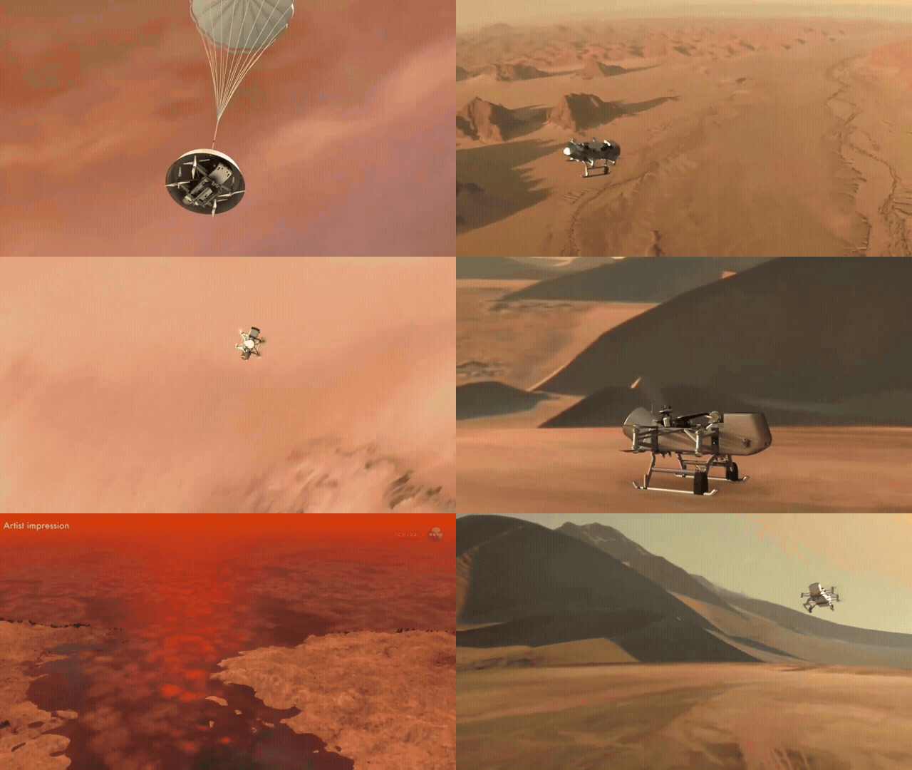
Space & Technology
LAUREL, Maryland — March 2026 : NASA has formally entered the full integration and testing phase of its Dragonfly mission, a nuclear-powered rotorcraft lander designed to explore Saturn’s largest moon, Titan. The milestone marks the transition from design and simulation to physical assembly of the flight system at the Johns Hopkins Applied Physics Laboratory (APL) in Laurel, Maryland, following the mission’s Critical Design Review. Dragonfly is scheduled to launch no earlier than July 2028 aboard a SpaceX Falcon Heavy rocket from Kennedy Space Center, beginning an approximately six-year cruise to Titan with arrival targeted in 2034. The mission, with an estimated cost of $3.35 billion, is designed to conduct the first aerial exploration of another planetary body. Integration and Testing Progress Across Multiple Facilities Integration activities began in early March 2026, with engineers at APL focusing on the spacecraft’s core avionics systems. The Integrated Electronics Module (IEM), which functions as the central computing and data-handling unit, and the Power Switching Units (PSUs) have been successfully powered on and tested through the lander’s main electrical harness. Additional subsystems, including the flight radio and communications hardware, are scheduled for delivery and integration over the coming months. Parallel work is ongoing at Lockheed Martin Space in Littleton, Colorado, where the aeroshell and cruise-stage components are undergoing assembly and testing. These systems will protect the spacecraft during its interplanetary transit and atmospheric entry at Titan. Thermal and environmental validation is also underway. APL is conducting tests in a dedicated “Titan Chamber” to evaluate the performance of the spacecraft’s approximately 3-inch-thick Solimide-based insulating foam under cryogenic conditions. Full system-level environmental testing is planned for 2027 ahead of final launch preparations. Aerodynamic validation has already been completed at NASA’s Langley Research Center using heavy gases in the Transonic Dynamics Tunnel to simulate Titan’s dense atmospheric conditions. Mission Profile and Flight Plan Dragonfly will launch during a window between July 5 and July 25, 2028. After a deep-space cruise lasting roughly six years, the spacecraft will enter Titan’s atmosphere and execute a descent sequence lasting approximately two hours—significantly longer than Mars landings due to Titan’s thick atmosphere. Upon arrival, Dragonfly will initially land in the Shangri-La dune fields near Titan’s equatorial region. The mission will then follow a multi-site “leapfrog” exploration strategy, progressively relocating across the surface toward Selk Crater, a scientifically significant impact site where past interactions between liquid water and organic materials may have occurred. The primary science phase is planned for approximately 3.3 years, during which the rotorcraft is expected to visit between 20 and 30 locations and travel up to 115 kilometers (70 miles). Rotorcraft Design and Flight Capabilities Dragonfly is a fully autonomous, car-sized rotorcraft lander designed to operate in Titan’s unique environment. The vehicle measures approximately 3.85 meters in length and width and 1.75 meters in height, with a mass ranging between 450 kilograms (landing configuration) and approximately 875 kilograms depending on system configuration references. Its structure consists of aluminum panels, internal decks, an aluminum honeycomb fuselage, and polymethacrylimide-based foam insulation for thermal protection. The rotor system uses an X8 octocopter configuration with eight rotors arranged in four pairs of coaxial, counter-rotating blades mounted on four arms. Each rotor has a diameter of approximately 1.35 meters (53 inches). This distributed electric propulsion system provides redundancy, allowing continued flight even in the event of partial system failure. Titan’s atmosphere—composed primarily of nitrogen with methane components—is approximately four times denser than Earth’s, while surface gravity is about one-seventh of Earth’s. These conditions reduce the power required for flight by a factor of roughly 40 compared to Earth, enabling efficient powered flight. The rotorcraft is designed to cruise at approximately 10 meters per second, reach altitudes up to 4,000 meters, and cover distances of 8 to 10 kilometers per flight. Each flight is expected to last about 30 minutes and occur once every Titan day (approximately 16 Earth days), with energy accumulated during the preceding night. Autonomous Navigation and Communications Due to the distance between Earth and Saturn, communication delays range from one to two hours one-way, making real-time control impossible. Dragonfly is therefore designed for full autonomy. Navigation systems include lidar, inertial measurement units, navigation cameras, pressure sensors, and wind sensors to assess terrain and atmospheric conditions in real time. The spacecraft will autonomously select safe landing zones and execute pre-programmed flight paths. Communications will be conducted via NASA’s Deep Space Network using a combination of high-gain and medium-gain antennas, supported by a 100-watt traveling-wave tube amplifier and an X-band Frontier radio developed by APL. Nuclear Power System and Energy Management Solar power is not viable on Titan due to extremely low sunlight levels—approximately 0.001 percent of that received by Earth. Dragonfly is therefore powered by a Multi-Mission Radioisotope Thermoelectric Generator (MMRTG) supplied by the U.S. Department of Energy. The MMRTG uses the decay of plutonium-238 dioxide to generate heat, which is converted into electricity through 768 thermocouples using the Seebeck effect. The system contains eight General Purpose Heat Source (GPHS) modules, each housing plutonium fuel pellets clad in iridium and protected by graphite and carbon-based shielding. At the beginning of its operational life, the MMRTG produces approximately 110 watts of electrical power and about 2,000 watts of thermal energy. By the time Dragonfly reaches Titan after its six-year cruise, electrical output is expected to decline to approximately 70–72 watts. Energy is stored in a 134 ampere-hour lithium-ion battery, which is charged continuously by the MMRTG, particularly during Titan’s approximately eight-Earth-day night. The stored energy is then used to power flight operations during the daytime. The MMRTG also plays a critical role in thermal management by providing continuous waste heat to maintain internal temperatures during both cruise and surface operations. The system has no moving parts, contributing to long-term reliability, and is based on the same technology used in NASA’s Curiosity and Perseverance Mars rovers. Scientific Instruments and Payload Capabilities Dragonfly carries a comprehensive suite of scientific instruments designed to investigate Titan’s chemistry, geology, and atmospheric processes: The Dragonfly Mass Spectrometer (DraMS), developed by NASA’s Goddard Space Flight Center, will analyze drilled samples for complex organic molecules and prebiotic chemistry. The Dragonfly Gamma-Ray and Neutron Spectrometer (DraGNS), developed by APL and Goddard, will measure elemental composition beneath the surface without direct sampling. The Dragonfly Geophysics and Meteorology Package (DraGMet), developed by APL, will monitor atmospheric conditions, including temperature, pressure, wind, and seismic activity. The DragonCam imaging system, developed by Malin Space Science Systems, will provide both macroscopic and microscopic imaging capabilities for terrain mapping and material analysis. The spacecraft is equipped with drill systems mounted on its landing skids, enabling collection of surface and shallow subsurface samples. A pneumatic transfer system delivers these samples directly to onboard instruments for analysis. Environmental Challenges and Engineering Solutions Titan presents a combination of extreme environmental conditions. Surface temperatures average approximately −179 degrees Celsius, requiring advanced insulation and continuous heating from the MMRTG. The dense atmosphere extends the entry, descent, and landing phase to approximately two hours. Additionally, Titan’s long rotational period—equivalent to about 16 Earth days—creates slow-changing atmospheric dynamics that must be accounted for in mission planning. Power management remains a key constraint due to the limited electrical output of the MMRTG. Flight operations, scientific measurements, and communications must be carefully scheduled to balance energy consumption and battery recharge cycles. Radiation effects from the RTG on spacecraft systems were analyzed during development using Monte Carlo N-Particle (MCNP) simulations to ensure instrument integrity. Mission Duration and Long-Term Operations The total mission duration, including cruise and surface operations, is expected to be approximately 10 years. The MMRTG itself is designed for an operational lifespan of up to 17 years, including pre-launch storage. The plutonium-238 fuel has a half-life of approximately 88 years, allowing for extended mission potential beyond the nominal science phase, provided mechanical systems remain functional in Titan’s harsh environment. Dragonfly’s mobility represents a significant advancement over traditional stationary landers, enabling repeated sampling across diverse geological environments. Scientific Significance Building on data from the Cassini-Huygens mission, Dragonfly is designed to investigate Titan’s carbon-rich environment and assess its potential for prebiotic chemistry and habitability. The mission will provide insights into chemical processes that may resemble those that preceded the emergence of life on Earth. With integration and testing continuing through 2027, NASA’s Dragonfly mission remains on track for its planned 2028 launch, marking a major step forward in planetary exploration using aerial robotic systems.
Read More → Posted on 2026-03-26 18:04:32
Space & Technology
WASHINGTON, — March 24, 2026 : NASA has formally advanced plans for its first nuclear-powered interplanetary spacecraft, Space Reactor-1 (SR-1) Freedom, with a launch target set for no earlier than December 2028. The mission is designed to demonstrate nuclear-electric propulsion in deep space and deploy a new class of aerial robotic assets on Mars, marking a significant step in long-duration exploration capabilities. The program is being executed in partnership with the U.S. Department of Energy (DOE), which is supporting reactor design, safety systems, and nuclear integration. Mission Architecture and Spacecraft Design SR-1 Freedom will be the first spacecraft to employ a nuclear fission reactor as its primary onboard power source for interplanetary propulsion. The reactor is designed to generate approximately 25 kilowatts of continuous electrical power, which will be used to operate high-efficiency ion thrusters. Unlike conventional chemical propulsion, which relies on combustion, the spacecraft will use electrically powered ion propulsion. These thrusters accelerate charged particles to produce steady, low-thrust propulsion over extended durations, enabling more efficient mass transport across deep space. The spacecraft bus is derived from NASA’s Power and Propulsion Element (PPE), originally developed for the Lunar Gateway program. While PPE was designed for solar-electric propulsion, SR-1 Freedom replaces the solar array system with a compact nuclear reactor while retaining core electric propulsion architecture, including power distribution systems, thruster integration, and long-duration operational capability. The mission will launch aboard a conventional chemical rocket from Earth. The nuclear system will remain inactive during launch and early ascent, with activation planned only after the spacecraft reaches a safe distance in space. First Use of Integrated Nuclear-Electric Propulsion Beyond Earth Orbit The SR-1 Freedom mission represents the first operational use of nuclear-electric propulsion for travel beyond Earth orbit. The system combines three key elements for the first time in a single deep-space platform: A compact space-rated nuclear fission reactor Continuous electric power generation at multi-kilowatt scale Long-duration ion propulsion for interplanetary transit This integrated architecture is expected to provide higher efficiency compared to both chemical propulsion and traditional solar-electric systems. It also reduces dependence on large solar arrays, which lose effectiveness at greater distances from the Sun, particularly in missions extending beyond Mars and toward the outer solar system. “Skyfall” Payload and Aerial Exploration Assets Upon arrival at Mars, SR-1 Freedom will deploy a specialized payload known as Skyfall. This payload introduces a new deployment concept and a new class of aerial exploration systems. Skyfall consists of three next-generation autonomous helicopters based on the Ingenuity technology demonstrator, which operated on Mars from 2021 to 2024. These rotorcraft represent an evolution in Martian aerial systems with improved endurance, sensing, and autonomy. For the first time, aerial assets will be deployed mid-air during atmospheric descent rather than being delivered via a traditional lander platform. This approach removes the requirement for complex entry, descent, and landing systems associated with large surface payloads. Once deployed, the three helicopters will operate independently and conduct coordinated exploration missions. Their planned functions include: High-resolution surface imaging Subsurface radar scanning to detect water and ice Terrain mapping for future landing site identification Environmental and atmospheric observations The use of multiple aerial vehicles also introduces redundancy and distributed coverage, expanding the operational footprint compared to single-vehicle missions. Data Collection and Technology Demonstration Objectives A central objective of SR-1 Freedom is to collect comprehensive engineering and scientific data on nuclear-electric propulsion in an operational environment. Key data areas include: Reactor performance and stability over long durations Power conversion efficiency and electrical distribution Thermal management of a space-based fission system Ion propulsion performance under continuous operation System integration between nuclear power and propulsion modules The mission will also gather planetary science data through the Skyfall helicopters, particularly in identifying subsurface resources such as water ice, which is critical for future human missions. New Capabilities and First-Time Systems SR-1 Freedom incorporates several systems and operational concepts being used for the first time in a Mars mission: First deployment of a nuclear fission reactor for primary propulsion power in deep space First integration of nuclear power with ion propulsion for interplanetary travel First reuse and modification of the Lunar Gateway PPE as a nuclear-powered spacecraft bus First mid-air deployment of multiple aerial vehicles in the Martian atmosphere First use of a distributed helicopter fleet for coordinated planetary exploration These elements collectively represent a shift toward modular, power-rich spacecraft capable of supporting sustained operations far from Earth. Strategic Role in Future Exploration NASA and the DOE have stated that SR-1 Freedom is intended to establish the technical and regulatory foundation for future nuclear-powered missions. The data and operational experience gained are expected to support multiple long-term objectives. For lunar exploration, similar fission systems are being considered to provide continuous surface power for sustained human presence. In Mars exploration, nuclear-electric propulsion could enable transport of heavier cargo, habitats, and eventually crewed missions with improved efficiency. For missions to the outer solar system, where solar power becomes increasingly limited, nuclear systems offer a scalable solution for both propulsion and onboard energy needs. Development Status and Timeline The SR-1 Freedom project has entered active development, with NASA coordinating with commercial aerospace partners for spacecraft integration, propulsion systems, and aerial vehicle development. The DOE continues to lead reactor design and safety validation. All systems are expected to undergo extensive ground testing, including reactor safety validation, propulsion endurance testing, and integrated system verification before launch. The mission is currently targeting a launch window no earlier than December 2028.
Read More → Posted on 2026-03-24 16:59:46
Space & Technology
SEOUL — March 22, 2026 : A North Korean-linked cyber threat group, tracked as UNC5342, has incorporated blockchain-based infrastructure into its operations by embedding malware within smart contracts on public networks, according to findings from Google Threat Intelligence Group. The activity represents an evolution in state-linked cyber operations, using decentralized blockchain systems such as Ethereum and BNB Smart Chain to distribute malicious payloads and maintain command-and-control (C2) functionality. Use of EtherHiding Technique The method, known as EtherHiding, involves storing encrypted malicious payloads inside blockchain smart contracts. These contracts function as decentralized repositories from which malware retrieves instructions or secondary payloads without relying on traditional centralized servers. Security researchers note that this is the first documented instance of a nation-state actor adopting this technique at scale. UNC5342 has been observed using EtherHiding since February 2025, building on earlier criminal use cases identified in 2023. The approach enables attackers to leverage the immutability and decentralization of blockchain networks, making the hosted malicious code resistant to takedown or disruption. “Contagious Interview” Campaign The blockchain-based delivery method is integrated into a broader social engineering campaign known as the “Contagious Interview” operation, which targets software developers, particularly in the cryptocurrency and technology sectors. The attack chain typically unfolds in multiple stages: Initial Contact: Attackers impersonate recruiters on platforms such as LinkedIn or job boards Engagement Shift: Conversations are moved to messaging platforms including Telegram or Discord Payload Delivery: Victims are asked to complete coding tests or download files from GitHub repositories or malicious npm packages Execution: The downloaded files contain a lightweight JavaScript-based downloader known as JADESNOW Once executed, JADESNOW initiates a read-only query to blockchain explorer APIs such as Blockchair, Ethplorer, or BscScan. These queries retrieve encrypted payloads stored within smart contracts or transaction data. Malware Payload and Capabilities The retrieved payloads are typically Base64-encoded and XOR-encrypted. After decryption, they deploy secondary malware components, most notably the INVISIBLEFERRET backdoor, available in both JavaScript and Python variants. INVISIBLEFERRET establishes persistence on the infected system and enables remote control. It is designed to extract: Credentials from browsers such as Chrome and Edge Data from password managers, including 1Password Cryptocurrency wallet information from applications such as MetaMask and Phantom Collected data is compressed into archive files and exfiltrated to attacker-controlled infrastructure, including remote servers or Telegram channels. Additional payloads may be retrieved from separate blockchain transactions. The campaign supports both financial theft of cryptocurrency assets and long-term network access for espionage purposes. Operational Advantages of Blockchain-Based Delivery The use of blockchain infrastructure provides several operational benefits for attackers: Immutability: Smart contract data cannot be deleted or altered once deployed, ensuring persistent availability of malicious payloads Decentralization: No central server exists that can be seized or shut down by law enforcement or cybersecurity teams Low Cost: Updating payloads within smart contracts can cost as little as $1.37 in gas fees on BNB Smart Chain Anonymity: Blockchain addresses are pseudonymous, complicating attribution Examples identified by researchers include a BNB Smart Chain contract that was updated more than 20 times over four months, demonstrating the ability to continuously modify payloads while maintaining persistent access. Related Tools and Campaign Overlap A related malware framework, EtherRAT, observed in late 2025 during exploitation of the React2Shell vulnerability (CVE-2025-55182), also uses Ethereum smart contracts for command-and-control resolution. EtherRAT queries blockchain data to retrieve updated C2 server addresses and establishes persistence on Linux systems. While direct code overlap has not been confirmed in all cases, researchers note operational similarities linking it to the same broader campaign cluster. UNC5342 is also tracked under multiple designations by cybersecurity firms, including CL-STA-0240, DeceptiveDevelopment, DEV#POPPER, Famous Chollima, Gwisin Gang, Tenacious Pungsan, and Void Dokkaebi. Limits of Mitigation and Response Because blockchain systems are inherently immutable, removal of malicious smart contract data is not possible. Once deployed, the code remains accessible for the lifetime of the network. However, mitigation efforts can focus on disrupting other stages of the attack chain: Blocking Web3 APIs: Malware relies on public RPC endpoints and blockchain explorer APIs rather than running full nodes; restricting access can interrupt payload retrieval Endpoint Detection: Behavioral monitoring can identify execution of JADESNOW and INVISIBLEFERRET Network Monitoring: Tracking connections to known malicious contract addresses and blockchain services can provide visibility User Controls: Preventing execution of unverified scripts and enforcing multi-factor authentication reduces exposure File-based indicators, such as known hashes of JADESNOW samples, can also assist in detection, though the dynamic nature of payload updates limits the effectiveness of signature-based tools. Strategic Context The adoption of blockchain-based malware delivery reflects a broader trend toward resilient, decentralized infrastructure in cyber operations. By integrating EtherHiding into its toolkit, UNC5342 has expanded its ability to maintain persistent access and evade traditional countermeasures. The activity aligns with North Korea’s established focus on cryptocurrency theft and cyber-enabled revenue generation, while also supporting intelligence-gathering objectives through supply-chain and developer-targeted intrusions. Security researchers note that the technique is likely to evolve further, with attackers potentially expanding to additional blockchain networks and refining payload delivery methods.
Read More → Posted on 2026-03-22 17:23:15
Space & Technology
SAN JOSE, California — March 17, 2026 : NVIDIA has announced a new computing platform designed for space-based artificial intelligence operations, introducing the “Vera Rubin Space-1” module during its GPU Technology Conference (GTC) 2026. The announcement was made by Chief Executive Officer Jensen Huang on March 16, outlining the company’s plan to extend high-performance computing infrastructure into orbit. Huang confirmed that NVIDIA is actively working toward deploying data center capabilities in space, building on its existing presence in satellite-based computing. He noted that some of the company’s hardware is already qualified for orbital environments, including radiation-tolerant systems, and indicated that future efforts will focus on scaling these capabilities into full orbital data center architectures. Platform Architecture and Performance The Vera Rubin Space-1 module is based on NVIDIA’s next-generation Rubin architecture, combining Rubin GPUs with Vera CPUs in a tightly integrated design. The system is engineered for size-, weight-, and power-constrained (SWaP) environments typical of satellites and orbital platforms. According to NVIDIA, the Rubin GPU used in the module can deliver up to 25 times higher AI compute performance for space-based inference compared to the current-generation H100 GPU. The platform is designed to support both inference and training workloads, including large language models and other foundation models, directly in orbit. The module incorporates high-bandwidth interconnects between CPU and GPU components to process large volumes of data generated by onboard sensors. It is also designed to operate using solar power, aligning with standard energy systems used in satellites. Purpose and Operational Model The Vera Rubin Space-1 system is intended to address limitations in current satellite data processing workflows. Earth-observation satellites and other space-based sensors generate large volumes of raw data, often reaching petabyte scale. This data is typically transmitted to ground-based data centers for processing, creating bottlenecks due to limited downlink bandwidth and communication windows. By enabling data-center-class processing directly in orbit, the Space-1 module allows satellites to analyze raw data at the source. This includes processing optical imagery, radar signals, and other sensor outputs in real time. Instead of transmitting full datasets, satellites can send back processed insights, reducing bandwidth requirements and latency. The platform is expected to support a range of applications, including geospatial intelligence, near real-time Earth observation, autonomous satellite operations, and distributed orbital data centers (ODCs). It also aligns with broader industry efforts to shift computing closer to data generation points. Engineering Constraints in Space Deploying high-performance computing systems in orbit introduces several technical challenges, particularly in thermal management. Unlike Earth-based data centers, space environments lack air and liquid mediums for heat transfer through convection or conduction. As a result, cooling must rely entirely on thermal radiation. NVIDIA engineers are working on solutions that use radiative cooling systems, which dissipate heat by emitting infrared radiation into space. However, effective radiators can increase system size and mass, creating trade-offs with launch constraints and payload costs associated with commercial rockets. Radiation exposure is another key consideration. Space-based electronics must withstand cosmic radiation that can cause data corruption and hardware faults. To mitigate these risks, systems may use techniques such as lockstep processing—where duplicate computations are performed and compared—and Error Correction Code (ECC) memory to maintain data integrity. Integration with Existing NVIDIA Space Systems The Vera Rubin Space-1 module is part of a broader ecosystem of NVIDIA hardware designed for space applications. It is intended to integrate with platforms such as IGX Thor and Jetson Orin, which are already used in edge AI and embedded systems. NVIDIA has previously deployed hardware in orbit, including an H100 GPU tested in 2025 through collaboration with commercial partners. The new module represents a continuation of these efforts, moving toward more capable and scalable orbital computing systems. Industry Partnerships and Deployment Plans NVIDIA confirmed that six aerospace and satellite companies—Aetherflux, Axiom Space, Kepler Communications, Planet Labs, Sophia Space, and Starcloud—are working with the company to incorporate its accelerated computing platforms into upcoming missions. Some partners are developing specialized infrastructure to support orbital data processing. Starcloud, for example, is focused on building dedicated orbital data centers, while Planet Labs plans to use onboard AI processing for near real-time analysis of Earth imagery. The Vera Rubin Space-1 module is not yet commercially available, and NVIDIA has not provided a specific deployment timeline for full-scale orbital data centers. Initial implementations are expected to follow a hybrid approach, combining ground-based infrastructure with increasingly capable satellite-based computing nodes. Outlook NVIDIA’s announcement reflects growing interest in space-based computing as satellite constellations expand and data volumes increase. The Vera Rubin Space-1 module is positioned as a step toward enabling distributed AI infrastructure beyond Earth, with an emphasis on reducing latency, improving data efficiency, and supporting autonomous operations in orbit. While significant engineering challenges remain—including thermal control, radiation resilience, and launch economics—the development indicates a shift toward integrating advanced computing capabilities directly into space systems.
Read More → Posted on 2026-03-17 17:58:21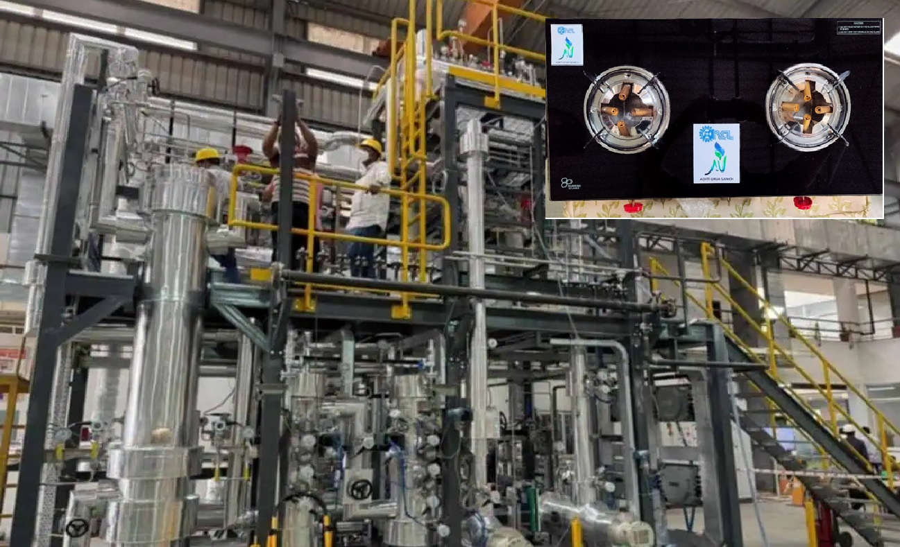
Space & Technology
PUNE, INDIA — March 15, 2026 : Scientists at the Council of Scientific and Industrial Research – National Chemical Laboratory (CSIR-NCL) in Pune have developed and scaled a patented technology to produce dimethyl ether (DME), a clean-burning synthetic fuel that can be blended with or used as an alternative to liquefied petroleum gas (LPG). Researchers say the indigenous process could help reduce India’s dependence on imported LPG while strengthening domestic energy production. The technology converts methanol into dimethyl ether using a specially designed catalyst, allowing the fuel to be produced efficiently and handled through infrastructure already used for LPG distribution. Indigenous Catalyst and Production Process The technology was developed by a research team led by Thirumalaiswamy Raja, Chief Scientist in the Catalysis Division at CSIR-NCL. The process integrates catalyst chemistry and reactor engineering to convert methanol into dimethyl ether in a controlled catalytic reaction. Dimethyl ether is produced through a catalytic dehydration process, in which methanol molecules react over a solid catalyst at elevated temperature and moderate pressure. In this reaction, two methanol molecules combine and release a molecule of water, forming DME as the main product. The simplified chemical reaction is: 2CH₃OH → CH₃OCH₃ + H₂O In the CSIR-NCL system, methanol vapor is passed through a fixed-bed catalytic reactor containing the indigenous catalyst developed by the laboratory. Under reaction conditions, typically at around 10 bar pressure, the catalyst accelerates the dehydration reaction, converting methanol into dimethyl ether and water vapor. After the reaction stage, the product mixture is cooled and separated. The dimethyl ether is condensed and purified, while water and any unreacted methanol are removed or recycled back into the reactor system to improve efficiency. Researchers say the catalyst developed at CSIR-NCL offers high activity, selectivity, and long operational life, helping lower operational costs and improving conversion efficiency compared with conventional catalyst systems. Because the process operates at relatively low pressure, the produced DME can be liquefied and filled directly into conventional LPG cylinders, enabling integration with existing storage and distribution infrastructure. The technology has already been demonstrated through a pilot plant capable of producing approximately 250 kilograms of DME per day, validating the catalytic process at a pre-commercial scale. Compatibility With Existing LPG Infrastructure Dimethyl ether has physical properties similar to LPG, particularly its ability to remain in liquid form under moderate pressure. This makes it compatible with the infrastructure already used to store, transport, and distribute LPG. Technical assessments show that blending up to 8% DME with LPG requires no modifications to existing cylinders, regulators, valves, hoses, gaskets, or household cooking burners. Regulatory approval for such blending has been established through the IS 18698:2024 standard issued by the Bureau of Indian Standards, which allows up to 20% DME blending with LPG for domestic, commercial, and industrial applications. Flex-Fuel Burner Development To enable higher blend ratios or potential full substitution in the future, CSIR-NCL scientists have also developed a patented flex-fuel burner prototype capable of operating on 100% LPG, 100% DME, or any mixture between the two fuels. The burner prototype was tested at the LPG Equipment Research Centre in Bengaluru, where performance trials demonstrated stable combustion and acceptable efficiency across different blending ratios. Such equipment could support gradual increases in DME usage without requiring widespread replacement of household cooking devices. Potential Economic Impact India remains heavily dependent on imported fossil fuels. The country imports more than 80% of its fossil energy requirements, including significant quantities of LPG used in domestic cooking and commercial applications. In 2024, India imported nearly 21 million tonnes of LPG, contributing substantially to the national energy import bill. Researchers estimate that substituting about 8% of LPG consumption with domestically produced DME could generate annual foreign exchange savings of approximately ₹9,500 crore. Supplying this level of substitution for the roughly 10.5 crore LPG connections under the Pradhan Mantri Ujjwala Yojana would require around 1,300 tonnes of DME production per day nationwide. Environmental Characteristics Dimethyl ether burns cleaner than many conventional fuels. Combustion studies show that it produces very low levels of soot and particulate matter, while emissions of nitrogen oxides (NOx) and sulfur oxides (SOx) are significantly reduced. The fuel’s thermal efficiency is comparable to LPG, allowing it to provide similar cooking performance while producing fewer combustion pollutants. Beyond cooking fuel applications, DME can also be used as: an automotive fuel substitute for diesel in modified engines, a propellant in aerosol products replacing ozone-depleting chlorofluorocarbons, a chemical intermediate for manufacturing lower olefins, dimethyl sulfate, and methyl acetate. Industrial Scale Demonstration Plans Following successful pilot testing, CSIR-NCL is preparing to scale the technology to an industrial demonstration plant capable of producing around 2.5 tonnes of DME per day. The facility is expected to be developed within six to nine months in collaboration with process engineering partners. If the demonstration phase is successful, the technology could be expanded to commercial plants producing between 50 and 500 tonnes of DME per day, depending on demand and industrial partnerships. The laboratory is currently exploring collaboration opportunities with oil public sector undertakings (PSUs) and bioenergy companies to support commercialization and large-scale deployment. Future Feedstock Options Scientists involved in the project say the methanol required for DME production could be produced through multiple domestic pathways. These include coal-to-methanol conversion using India’s coal reserves, biomass gasification, and methanol synthesized from captured carbon dioxide. Such feedstock flexibility could allow DME production to integrate with broader energy transition strategies while supporting domestic fuel manufacturing. Role in India’s Energy Strategy Researchers say the development aligns with national efforts to expand indigenous energy technologies under the Atmanirbhar Bharat initiative. If deployed at large scale, dimethyl ether blending could provide a domestically produced supplement to LPG, helping reduce import dependence while maintaining compatibility with India’s existing cooking fuel distribution infrastructure.
Read More → Posted on 2026-03-15 14:25:30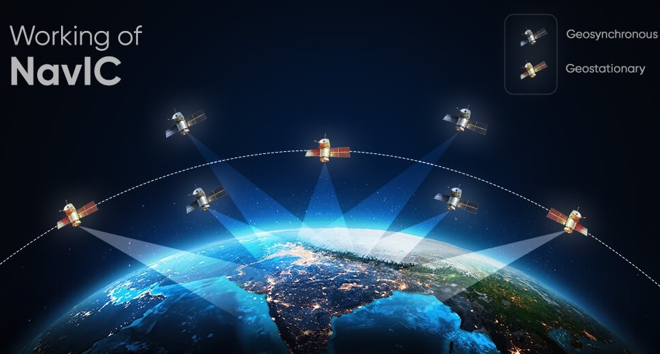
Space & Technology
BENGALURU — March 14, 2026 : India’s regional satellite navigation network, Navigation with Indian Constellation (NavIC), is currently operating below its minimum operational threshold after the failure of the final onboard atomic clock aboard the IRNSS-1F satellite. The malfunction has reduced the number of satellites capable of providing full Positioning, Navigation and Timing (PNT) services to three, according to the Indian Space Research Organisation. NavIC is designed to provide accurate regional navigation coverage across India and up to roughly 1,500 kilometers beyond its borders. The system requires at least four fully functional satellites with working atomic clocks to deliver reliable navigation services. With the loss of IRNSS-1F, the constellation has temporarily dropped below that operational requirement. IRNSS-1F Completes Mission Life Before Clock Failure IRNSS-1F was launched on March 10, 2016 as part of the original NavIC constellation deployment. The satellite was designed for a mission life of ten years and officially completed its planned operational lifespan on March 10, 2026. On March 13, 2026, the last remaining rubidium atomic clock aboard the satellite stopped functioning. Two redundant clocks on the spacecraft had previously failed, leaving the satellite unable to generate navigation signals once the final clock ceased operation. Although IRNSS-1F can no longer support navigation services, ISRO stated that the spacecraft will remain in orbit. It will continue to broadcast one-way messaging services used for certain societal and disaster-management applications. Atomic clocks are the core component of satellite navigation systems. Precise time measurement allows satellites to calculate signal travel time to receivers on Earth. Even very small timing errors can produce large inaccuracies in determining position. Current Operational NavIC Satellites Since 2013, ISRO has launched a total of eleven satellites to establish and maintain the NavIC constellation. Following the IRNSS-1F failure, only three satellites currently retain functioning atomic clocks capable of providing full navigation services. The operational satellites currently supporting PNT services are IRNSS-1B, launched in April 2014; IRNSS-1I, launched in April 2018 as a replacement satellite; and NVS-01, the first second-generation NavIC satellite launched in May 2023. These spacecraft are now carrying the primary navigation workload for the system. First-Generation Satellite Failures Several first-generation IRNSS satellites have lost navigation capability primarily due to failures in imported rubidium atomic clocks used during the initial phase of the program. IRNSS-1A, launched in July 2013 with a 10-year design life, became non-operational for navigation after all three of its atomic clocks failed. IRNSS-1C, launched in October 2014, also lost navigation capability due to clock malfunctions. IRNSS-1D, launched in March 2015, experienced similar atomic clock failures that degraded its ability to provide navigation services. IRNSS-1E, launched in January 2016, suffered comparable issues affecting its onboard timing systems. IRNSS-1F, launched in March 2016, has now joined the list after its final clock failure in March 2026. IRNSS-1G, launched in April 2016, also experienced clock-related issues affecting navigation performance. Replacement Satellite History To maintain the constellation, ISRO launched IRNSS-1H in August 2017 as a replacement satellite. However, the mission failed when the payload fairing of the PSLV-C39 launch vehicle did not separate, preventing the satellite from reaching orbit. IRNSS-1I was subsequently launched successfully in April 2018 to replace IRNSS-1A and remains operational today. Under the second-generation NavIC program, NVS-01 was launched in May 2023. The spacecraft introduced upgraded navigation payloads and an indigenously developed rubidium atomic clock. Another replenishment satellite, NVS-02, was launched on January 29, 2025 aboard a GSLV-F15 rocket. Although the launch itself was successful, the spacecraft failed to reach its intended operational orbit. NVS-02 Orbital Failure Investigation On February 25, 2026, ISRO released the failure analysis report for NVS-02. Investigators determined that a loose connector prevented a drive signal from reaching a critical pyro-valve responsible for oxidizer flow in the satellite’s propulsion system. Because the valve did not open correctly, oxidizer could not reach the engine. As a result, the satellite was unable to perform orbit-raising maneuvers required to reach its designated circular navigation orbit. Consequently, NVS-02 is not contributing to NavIC navigation services. Next-Generation NavIC Satellites To restore the constellation to full capability, ISRO is accelerating development of additional satellites under the second-generation NVS series. The agency plans to launch three more satellites — NVS-03, NVS-04 and NVS-05 — before the end of 2026. These spacecraft are intended both to restore the minimum operational threshold and to gradually replace aging first-generation satellites such as IRNSS-1B and IRNSS-1I. The new satellites incorporate several upgrades. Each spacecraft carries five indigenously developed rubidium atomic clocks to improve redundancy and reliability. The satellites also introduce additional signal bands, including L1 signals, to improve compatibility with civilian and military navigation receivers. Officials at ISRO’s Space Applications Centre have noted that procurement delays for certain components used in the indigenous clocks have slowed the replenishment schedule. Importance of Maintaining the Constellation NavIC represents India’s independent regional navigation capability and is used for civilian navigation, disaster management, transportation tracking and strategic applications. With only three satellites currently capable of delivering full navigation services, restoring the constellation through replacement launches has become a priority for ISRO. The planned deployment of additional NVS satellites is intended to bring the system back to its full operational configuration in the coming years.
Read More → Posted on 2026-03-14 14:31:48
Space & Technology
NEW DELHI — March 13, 2026 : The Government of India has expanded its investment in next-generation telecommunications research, approving 104 research and development projects focused on indigenous 6G technology. The initiatives, supported by a total allocation of ₹271 crore, are being funded through the Telecom Technology Development Fund (TTDF) administered by the Department of Telecommunications under the Ministry of Communications. The details were confirmed in a written response to the Rajya Sabha by Minister of State for Communications and Rural Development Pemmasani Chandra Sekhar, who stated that the approvals were in place as of February 2026. The projects form part of a broader government strategy aimed at strengthening domestic telecommunications research capabilities and reducing long-term reliance on imported telecom infrastructure and technology. Bharat 6G Vision and Strategic Objectives The funding initiative is aligned with the government’s long-term roadmap outlined in the Bharat 6G Vision Document, released in March 2023. The vision document establishes a national framework for research, development, and eventual deployment of sixth-generation telecommunications systems, targeting significant contributions by India to global 6G standards and intellectual property by the end of the decade. According to statements from Communications Minister Jyotiraditya Scindia, India’s telecommunications development strategy has evolved through successive technology generations. The government’s stated objective is that while the country followed global markets during the 4G era and deployed 5G alongside major economies, it aims to become one of the leading contributors to the development and standardization of 6G technologies. Structure of the Telecom Technology Development Fund The Telecom Technology Development Fund was created to promote indigenous research and commercialization of telecom technologies. The scheme provides financial and institutional support to multiple categories of participants, including academic institutions, technology startups, research laboratories, and established telecom industry companies. Projects funded under TTDF are typically structured as collaborative consortiums combining academic research capability with industry development capacity. The program emphasizes the creation of domestic intellectual property, advanced telecommunications components, and experimental infrastructure that can support future commercial deployments. As of February 2026, the government has approved a total of 136 projects under the scheme. Of these, 104 projects are dedicated specifically to 6G technology development. Focus Areas of the Approved 6G Projects The approved research programs cover multiple core technologies expected to underpin future 6G networks. Among the areas being developed are terahertz communication systems, which are considered a potential spectrum band for extremely high-speed wireless transmission in future networks. Other projects involve the development of transmitter modules, cell-free access point architectures, and reconfigurable intelligent surface hardware systems designed to dynamically control radio propagation environments. Research is also underway in artificial intelligence and machine learning–driven network architectures intended to support autonomous network management and optimization. Additional research areas include advanced optical communications, integration of non-terrestrial and satellite communication systems, and experimental infrastructure such as terahertz testbeds used to evaluate ultra-high-frequency wireless performance. The remaining projects funded under TTDF outside the core 6G portfolio include work on quantum communications, indigenous 5G core network technologies, satellite and non-terrestrial network systems, telecom cybersecurity frameworks, and next-generation optical transmission technologies. Development of Domestic Telecom Innovation Ecosystem The government has also established supporting infrastructure to accelerate telecommunications innovation. These include more than 100 5G use-case laboratories created across academic and technical institutions in India. The laboratories are intended to support experimentation, testing, and development of applications that may also contribute to future 6G technology frameworks. Officials have indicated that the development strategy relies on collaboration among universities, industry partners, and research institutions to create a multi-disciplinary telecommunications research ecosystem. Global Status of 6G Development Despite growing investments worldwide, sixth-generation telecommunications technology has not yet been fully developed or deployed anywhere globally. As of 2026, 6G remains in the research, standardization, and early prototyping stage. The international framework for 6G is currently being developed under the International Telecommunication Union (ITU), which refers to the future standard as IMT-2030. The organization approved the initial framework in 2023 and is currently defining technical performance requirements and evaluation methodologies, a process expected to continue through 2026. Under the standardization timeline, candidate radio interface technologies are expected to be submitted between 2027 and early 2029. Final IMT-2030 specifications are targeted for approval around 2030, which would allow early commercial deployment of 6G networks toward the end of the decade. Telecommunications standards body 3GPP is also preparing future technical releases, including Release 21, to support this timeline. International 6G Research Efforts Several regions are simultaneously investing in early 6G research and patent development. In North America, research coordination is being conducted through the Next G Alliance, an initiative involving telecommunications companies and research institutions from the United States and Canada. The program focuses on AI-native network architecture, cloud-based telecom infrastructure, and open network technologies. In Europe, major telecom equipment manufacturers such as Ericsson and Nokia are participating in the Hexa-X initiative, which is supported by the European Union. The project aims to define core system architecture and future network capabilities for 6G. East Asian countries including China, South Korea, and Japan are also actively conducting experimental testing in ultra-high-frequency spectrum bands and satellite communications relevant to future 6G networks. China currently holds the largest share of documented 6G-related patents, with more than 4,600 filings reported. The United States has recorded more than 2,200 patents, while South Korea has approximately 760 patents alongside government programs targeting early commercial services before 2030. India has recorded approximately 265 patents associated with 6G technologies as of recent assessments. India’s Position in the Global 6G Landscape India’s strategy focuses on expanding domestic intellectual property development, building technical expertise, and participating in international telecommunications standardization processes. Government officials have stated that the goal is for India not only to deploy 6G infrastructure domestically but also to contribute significantly to global telecom standards and technology frameworks by 2030. Through the combination of targeted research funding, academic-industry collaboration, and international participation in standards bodies, India aims to strengthen its role in the global telecommunications technology ecosystem during the development phase of sixth-generation networks.
Read More → Posted on 2026-03-13 16:12:59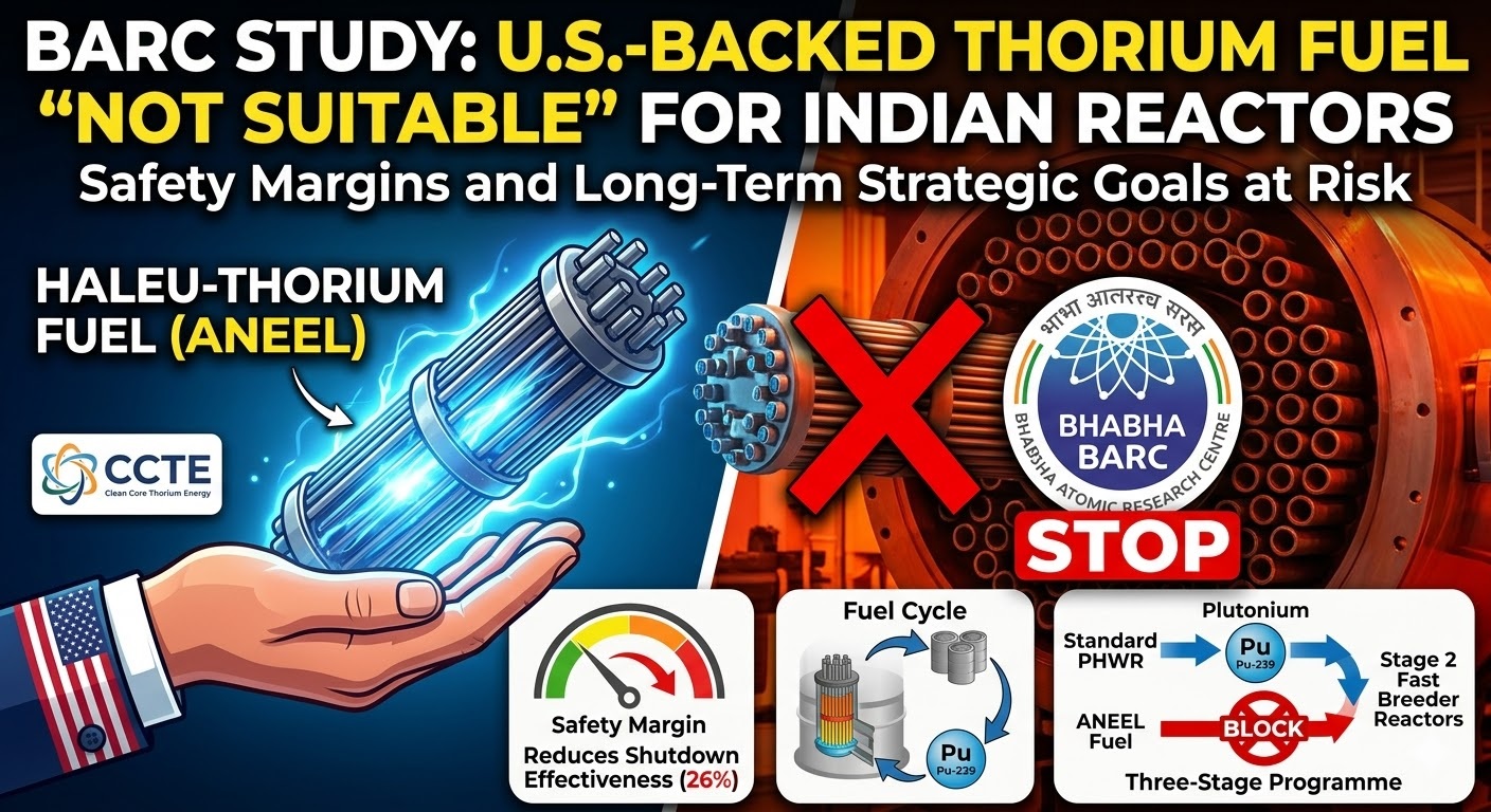
Space & Technology
NEW DELHI — March 10, 2026 : A new scientific assessment by researchers at the Bhabha Atomic Research Centre (BARC) has raised technical and strategic concerns about a proposal to introduce a U.S.-developed thorium-based fuel blend into India’s existing nuclear power reactors. The analysis concludes that the proposed High-Assay Low-Enriched Uranium (HALEU) and thorium fuel combination cannot be directly used in India’s Pressurized Heavy Water Reactors (PHWRs) without significant design changes and could interfere with the country’s long-standing nuclear fuel strategy. The findings were published in the journal Current Science by a BARC research team led by K.P. Singh of the Reactor Research Division. The study evaluates the performance of a HALEU-thorium fuel mixture intended for India’s standard 220 MWe PHWR reactors, which form a major part of the country’s nuclear power fleet. Fuel Concept Developed by U.S. Companies The fuel concept analyzed in the study forms the basis of ANEEL (Advanced Nuclear Energy for Enriched Life), a thorium-based nuclear fuel under development by the Chicago-based company Clean Core Thorium Energy (CCTE) in collaboration with Centrus Energy Corporation. ANEEL combines thorium with High-Assay Low-Enriched Uranium (HALEU)—uranium enriched to levels up to 19.75% uranium-235. Developers have presented the fuel as a potential “drop-in” replacement for the natural uranium currently used in Indian PHWRs, suggesting it could allow earlier utilization of thorium while improving fuel efficiency and reducing spent nuclear fuel volumes. Fuel pellets of the ANEEL design have undergone irradiation testing at the Advanced Test Reactor at Idaho National Laboratory in the United States to examine their behaviour under reactor conditions. Some Indian power producers have shown interest in the technology. NTPC Ltd., the country’s largest power generation company, has explored potential collaboration with CCTE for possible deployment in domestic reactors, subject to approval by the Government of India and the Department of Atomic Energy (DAE). Reactor Safety and Neutronics Concerns The BARC analysis compared the HALEU-thorium fuel cycle with the existing natural uranium fuel used in PHWRs by evaluating cluster-level optimization and full-core reactor performance parameters. According to the researchers, introducing the HALEU-thorium mixture would significantly alter the reactor’s neutronic behaviour and reactivity control characteristics. One key finding of the study is a reduction of approximately 26% in the effectiveness of the PHWR shutdown systems. These systems are designed to rapidly stop the nuclear chain reaction during abnormal operating conditions. The reduction results from changes in neutron flux distribution and reactivity coefficients caused by the different fuel composition. Because PHWRs are engineered specifically for natural uranium fuel moderated by heavy water, the study concludes that the proposed fuel blend would require substantial modifications to the reactor core design and control systems before safe operation could be achieved. As a result, the researchers state that the HALEU-thorium fuel cannot be considered a direct “drop-in” replacement for the existing fuel configuration in India’s operational reactors. Resource Utilisation and Uranium Consumption The study also examined resource utilisation associated with HALEU production. HALEU requires enrichment of uranium to levels approaching 20% U-235, significantly higher than the enrichment required for conventional light-water reactors and far above the natural uranium used in PHWRs. BARC scientists calculated that producing HALEU at 19.75% enrichment would increase the total amount of mined natural uranium required per unit of energy generated when compared with India’s current natural uranium fuel cycle. Although the HALEU-thorium mixture is designed to achieve higher burn-up levels—around 50 gigawatt-days per tonne (GWd/t)—and thereby reduce the total volume of spent fuel, the enrichment process introduces additional upstream resource demands. Impact on Plutonium Production Another major conclusion of the study relates to the production of plutonium in PHWR spent fuel. Under India’s current nuclear fuel cycle, PHWR reactors operating on natural uranium generate plutonium-239 as a byproduct. This plutonium is separated during reprocessing and used as the primary fissile material for the country’s Fast Breeder Reactor (FBR) programme. The BARC analysis indicates that the HALEU-thorium fuel cycle would produce significantly less plutonium compared with the natural uranium cycle. Reduced plutonium generation would limit the availability of fissile material required for India’s breeder reactors. The study also notes that the uranium-233 produced during thorium irradiation in the HALEU-thorium cycle would not be easily integrated into the existing closed fuel cycle system used by India’s PHWRs and breeder reactors. Interaction With India’s Three-Stage Nuclear Programme India’s nuclear power strategy is based on the three-stage nuclear programme originally developed by Dr. Homi J. Bhabha in the 1950s. The programme is designed to utilize the country’s limited uranium reserves and large thorium resources—estimated to account for roughly 25% of global thorium reserves. The three stages are structured as follows: Stage 1: Pressurized Heavy Water Reactors use natural uranium fuel to generate electricity and produce plutonium in spent fuel. India currently operates several PHWR units, including 220 MWe and 700 MWe reactors, which form the foundation of the programme. Stage 2: Fast Breeder Reactors use the plutonium recovered from PHWR spent fuel to breed additional fissile materials, including uranium-233 derived from thorium. Stage 3: Advanced thorium-based reactors are intended to operate primarily on U-233 fuel derived from thorium, enabling a self-sustaining nuclear energy cycle with reduced reliance on imported uranium. The BARC study concludes that introducing HALEU-thorium fuel in existing PHWRs would reduce plutonium accumulation, which is required for Stage 2 breeder reactors. This would slow the transition toward thorium-based energy systems envisioned in the final stage of the programme. Reactor Design Implications Because the HALEU-thorium fuel significantly changes reactor physics parameters, BARC researchers state that its implementation would require modified PHWR designs, including adjustments to safety systems and reactivity control mechanisms. Such modifications could involve changes to fuel bundle geometry, shutdown system design, and control rod configurations to compensate for the altered neutron spectrum and reactivity behaviour. The study indicates that these redesign efforts would involve additional engineering complexity and costs and could delay progress toward the long-term objectives of the national nuclear programme. India’s Ongoing Thorium Development Efforts India has been actively developing indigenous thorium-based reactor technologies within its own three-stage framework. One of the key projects in this effort is the Advanced Heavy Water Reactor (AHWR) design, which uses thorium-plutonium fuel combinations and incorporates passive safety systems intended to support large-scale thorium utilization in the future. The Department of Atomic Energy continues to pursue domestic thorium technologies alongside expansion of nuclear generation capacity. India has set a target of expanding nuclear power generation to around 100 gigawatts of installed capacity by 2047 as part of its long-term energy strategy. Policy Status The BARC study does not indicate that any official decision has been made regarding the adoption of HALEU-thorium fuel in Indian reactors. The proposal remains under technical evaluation, and any deployment would require approval from Indian nuclear authorities. The analysis concludes that while thorium-based fuels remain central to India’s long-term nuclear strategy, the specific HALEU-thorium configuration examined in the study is not compatible with current PHWR designs without significant modifications and could affect the fuel cycle structure underlying the country’s three-stage nuclear programme.
Read More → Posted on 2026-03-10 17:29:16
Space & Technology
EINDHOVEN, Netherlands — March 5, 2026 : An Indian trade delegation visited the semiconductor hub of Brainport Eindhoven in the Netherlands on March 4 to explore investment opportunities and discuss collaboration with Dutch companies involved in critical segments of the global chip ecosystem. The visit formed part of India’s broader strategy to strengthen its domestic semiconductor industry and integrate with international supply chains. The delegation was organized under the India Semiconductor Mission (ISM), an initiative of the Ministry of Electronics and Information Technology of the Government of India. It included operational and technical personnel responsible for implementing semiconductor projects rather than policy-level diplomats. The group was led by Manish Hooda, Director (Technology) at the ISM, and also included representatives from the Indian Embassy in the Netherlands and members of Indo-Dutch trade and innovation networks. The delegation’s primary objective was to engage with Dutch companies involved in semiconductor equipment, materials, and supply chain technologies and present India as a potential manufacturing and investment destination. Engagement With Dutch Semiconductor Firms Eindhoven and the surrounding Brainport region represent one of Europe’s most concentrated semiconductor clusters. The area hosts ASML, the world’s only manufacturer of extreme ultraviolet (EUV) lithography systems used in advanced chip production, as well as NXP Semiconductors, a major semiconductor developer headquartered in the region. During the visit, the Indian delegation held discussions with ASML, NXP Semiconductors, and numerous Tier-1 and Tier-2 suppliers involved in semiconductor equipment and materials. Approximately 50 to 60 Dutch companies requested meetings with the delegation, reflecting industry interest in exploring partnerships with India’s emerging semiconductor ecosystem. The focus of these meetings was on collaboration in areas such as manufacturing equipment, materials supply, and other specialized segments of the semiconductor value chain. Incentives Offered Under India Semiconductor Mission The delegation presented details of India’s financial incentive programs designed to attract semiconductor investment. The ISM initiative, launched in 2021, provides fiscal support covering up to 50 percent of eligible project costs for semiconductor fabrication facilities, compound semiconductor manufacturing, assembly-testing-marking-packaging (ATMP) facilities, and related supply chain segments. State governments in India supplement this support with additional incentives typically ranging from 20 to 25 percent. These incentives can include assistance with capital expenditure, land acquisition, power tariffs, infrastructure support, and workforce development programs. According to Manish Hooda, these combined measures are intended to reduce the financial burden on companies establishing semiconductor manufacturing or supply chain operations in India. Semiconductor Projects Under Development in India The delegation highlighted ongoing semiconductor initiatives in India as examples of progress under the ISM program. Eight projects have received approval under the framework, covering fabrication, packaging, and semiconductor design activities. A major project cited during discussions is the fabrication facility being developed through a joint venture between Tata Electronics and Powerchip Semiconductor Manufacturing Corp. The plant is being constructed in Dholera, located in the Indian state of Gujarat. Approved in February 2024 with an investment of approximately ₹91,000 crore (around $11 billion), the facility is designed for a production capacity of 50,000 wafer starts per month. The fab is expected to manufacture semiconductor nodes suitable for power management integrated circuits, display drivers, microcontrollers, and high-performance logic components used in automotive electronics, artificial intelligence systems, and 5G infrastructure. Construction is currently underway, and commercial operations are projected to begin in the late 2020s. Supply Chain Diversification and “China-Plus-One” Strategy During meetings in Eindhoven, Hooda stated that Dutch companies seeking to diversify manufacturing under a “China-plus-one” strategy should consider India as a production base outside China. The concept refers to multinational companies expanding manufacturing operations beyond China to reduce supply chain risks. The discussions took place against the backdrop of continuing export restrictions and technology controls related to advanced semiconductor equipment. These measures have encouraged companies to examine alternative locations for manufacturing and supply chain operations. India has positioned itself as a potential destination by offering financial incentives, a large engineering workforce, and a growing domestic electronics market. India–Netherlands Semiconductor Cooperation The March visit also aligns with broader bilateral cooperation efforts between India and the Netherlands in the semiconductor sector. A strategic partnership focused on semiconductor technologies is expected to be announced during a planned visit to the Netherlands by Narendra Modi, the Prime Minister of India, later in 2026. Earlier in January 2026, India’s Minister of Electronics and Information Technology Ashwini Vaishnaw visited the headquarters of ASML in Veldhoven. During that visit he indicated that the Dholera semiconductor fabrication facility would incorporate ASML lithography systems. ASML has also indicated plans to establish a support office in India. Existing Industry Links With India NXP Semiconductors already maintains a significant presence in India through research and development operations employing more than 3,000 engineers across multiple locations. Company leadership has indicated that India could account for approximately 8 to 10 percent of its global revenue in the coming years. India’s workforce presence in the Netherlands has also expanded over the past decade. The number of Indian professionals working in the country increased from roughly 30,000 in 2014 to about 89,000 in 2024. More than 10,000 of these professionals are based in the Eindhoven region, many of them employed in technology and semiconductor-related fields. Focus on Supply Chain Segments The March 4 visit did not result in immediate investment announcements or memoranda of understanding. Instead, the meetings were intended to establish relationships and initiate discussions with equipment suppliers and technology companies that form key parts of the semiconductor supply chain. This approach reflects India’s strategy of developing a broader semiconductor ecosystem by attracting not only fabrication facilities but also the specialized equipment manufacturers, materials providers, and design capabilities that support chip production. Further developments from these engagements are expected to emerge through continued industry discussions and upcoming diplomatic exchanges between India and the Netherlands later in 2026.
Read More → Posted on 2026-03-05 16:53:04
Space & Technology
MÖLNDAL, Sweden — February 26, 2026 : Kvaser has announced the global release of Kvaser Edge, a Linux-based edge computing platform designed for automotive and industrial data logging applications. The system is engineered to process, filter, and store data directly at the source — on vehicles, test benches, and industrial machines — reducing reliance on continuous PC connections and large-scale raw data transfers. Headquartered in Mölndal, Sweden, Kvaser brings more than 30 years of experience in Controller Area Network (CAN) and Local Interconnect Network (LIN) technologies. The company supplies machine-to-machine (M2M) communication solutions across automotive, aerospace, agriculture, industrial automation, marine, defense, medical, mining, bus and truck, and rail sectors. Edge Processing Designed for Modern Data Demands Kvaser Edge is built to address increasing data volumes generated during vehicle development, validation testing, and industrial machine monitoring. Traditional data logging workflows typically capture complete CAN traffic streams, producing extensive raw datasets that require post-processing on external computers. The new platform shifts analytics to the edge. It performs real-time filtering, data aggregation, anomaly detection, and event-based logging directly on the device. Instead of storing continuous full-stream data, the system records predefined relevant events, reducing storage requirements and network bandwidth usage. Processed data can be transmitted to cloud or local servers for further analysis when required. Primary application areas include real-time and remote diagnostics, predictive maintenance, intelligent event-based logging, fleet monitoring, off-highway telematics, and iterative test and development workflows. The device supports remote monitoring, troubleshooting, and secure remote access across distributed vehicle fleets or testing environments. Hardware Architecture and Environmental Design Kvaser Edge is a compact, rugged ARM-based Linux computer engineered for harsh operational environments. The unit carries an IP67 rating, providing resistance against dust and water ingress, and is designed to withstand extreme temperature variations typical in automotive and industrial settings. The platform includes: 256 GB eMMC internal storage Four galvanically isolated CAN/CAN FD channels implemented in FPGA Wi-Fi 6 connectivity Gigabit Ethernet USB ports supporting external storage, audio, and video peripherals Integrated 6-axis inertial measurement unit (IMU) GPS/GNSS support (external antenna required and sold separately) The device is rated for automotive-grade power conditions and is built to tolerate sudden voltage drops, engine cranking fluctuations, and abrupt shutdown scenarios. Both hardware and operating system components are designed to prevent data corruption during unexpected power loss. Hardware-Based Security and Regulatory Compliance Security is integrated at the hardware level through the inclusion of an NXP SE051C2 Secure Element. This dedicated cryptographic component provides a hardware root of trust, isolates credentials, and protects proprietary software, test algorithms, and collected data stored on the device. The hardware-based security architecture supports compliance with current European cybersecurity regulations, including the Cyber Resilience Act (CRA) and the Radio Equipment Directive (RED). The platform is therefore positioned for deployment in both early-stage prototyping environments and large-scale commercial applications where cybersecurity certification is required. Location-based security tracking is enabled through integrated GPS functionality, supporting fleet visibility and asset management use cases. Kvaser Edge OS and Containerized Workflows Kvaser Edge operates on Kvaser Edge OS (KEOS), a dedicated Linux-based operating system optimized specifically for data acquisition and edge analytics. KEOS supports containerized applications using Linux Containers (LXC). This architecture allows developers and test engineers to create isolated runtime environments layered on top of the base operating system. Within these containers, users can deploy preferred Linux distributions and specialized testing tools. Containerization enables multiple software versions to operate concurrently on the same device and allows application updates without modifying the underlying operating system. If a containerized application encounters an error, the issue remains isolated from the base system and other containers. This approach supports reproducible testing conditions across different vehicles and test rigs while avoiding software dependency conflicts. Industry Positioning and Ecosystem Integration The release of Kvaser Edge places the company within a competitive landscape of automotive edge computing and data logging providers. Companies such as Intrepid Control Systems offer solutions including the neoVI FIRE 3 COMPUTE platform for edge AI and Python-based CAN logging, while other vendors provide Raspberry Pi-based Docker-enabled telemetry systems. Kvaser Edge differentiates itself through its full open Linux environment combined with hardware-rooted security and deep integration with CAN and LIN communication systems. The company’s long-standing specialization in CAN technology supports precise, microsecond-level network timing requirements that are critical in automotive and industrial control environments. To facilitate system integration, Kvaser has launched a developer ecosystem that includes software development kits (SDKs), technical documentation, and example projects. Early adopters include software partner Alkit, which integrates Kvaser Edge into testing systems such as WICE for in-vehicle data collection workflows. Availability Kvaser Edge will be available for global distribution beginning in February 2026. Technical specifications, setup instructions, and developer resources are accessible through the Kvaser Edge Platform website and the company’s KEOS web-help portal. The platform represents Kvaser’s expansion from traditional CAN interface hardware into secure, containerized edge computing systems designed for modern vehicle and machine data processing requirements.
Read More → Posted on 2026-02-26 17:32:41
Space & Technology
SAN FRANCISCO, February 24, 2026 : U.S.-based artificial intelligence company Anthropic has formally accused three Chinese AI laboratories — DeepSeek, Moonshot AI and MiniMax — of conducting coordinated, large-scale distillation campaigns to extract capabilities from its Claude models, according to a company blog post published on February 23, 2026, and contemporaneous reporting by The Wall Street Journal, Reuters, Bloomberg and TechCrunch. Anthropic stated that the campaigns involved approximately 24,000 fraudulent accounts and generated more than 16 million exchanges with Claude. The company said the activity violated its terms of service and regional access restrictions, noting that Claude is not available in China. According to Anthropic, the laboratories used commercial proxy services and “hydra cluster” account architectures — networks of coordinated accounts — to evade detection and distribute traffic. The company said it traced account activity using request metadata and linked it to researchers at each laboratory. Breakdown of the Alleged Campaigns Anthropic provided a detailed account of the scope and focus of each operation. MiniMax was responsible for the largest volume of activity, generating more than 13 million exchanges. According to Anthropic, the campaign focused on agentic coding, tool use and orchestration capabilities. The company said it detected the operation while it was active and before the release of the model being trained. Anthropic added that when it released an updated Claude model during the period of activity, MiniMax redirected nearly half of its automated traffic to the new system within 24 hours in order to capture updated capabilities. Moonshot AI generated more than 3.4 million exchanges. Anthropic said the campaign targeted agentic reasoning, tool use, coding, data analysis, computer-use agent development and computer vision. The company reported that Moonshot AI initially operated hundreds of fraudulent accounts across multiple access pathways before shifting to a more targeted approach designed to reconstruct reasoning traces and internal step-by-step processes. DeepSeek conducted more than 150,000 exchanges. Although lower in total volume, Anthropic described the activity as highly specific. The company said DeepSeek targeted reasoning capabilities across diverse tasks, including rubric-based grading tasks used in reinforcement learning. Anthropic further alleged that DeepSeek used Claude to generate “censorship-safe” alternatives to politically sensitive queries involving dissidents, party leaders and authoritarianism. According to Anthropic, the associated accounts displayed synchronized traffic patterns, shared payment methods and coordinated timing consistent with load-balancing systems. Anthropic stated that the three laboratories relied on proxy services and coordinated account networks to bypass regional restrictions and usage limits. What Distillation Means in This Context Anthropic described model distillation as a standard machine-learning technique in which a large “teacher” model is used to train a smaller or more efficient “student” model. In legitimate internal use, developers feed a teacher model complex prompts, collect high-quality outputs and train a smaller system to replicate selected capabilities at lower computational cost. In the cases described, Anthropic alleged that the technique was used without authorization. Instead of training a model from scratch — a process that can require significant computational resources, time and access to training data — the laboratories allegedly generated millions of prompts to Claude, recorded its outputs and used those responses to accelerate development of their own systems. Anthropic referred to this practice as “illicit distillation” or a “distillation attack,” arguing that it enables rapid capability transfer at a fraction of the traditional cost of frontier model development. Security and Export Control Concerns Anthropic stated that the campaigns highlight potential weaknesses in export controls on advanced AI chips and models. The company argued that distillation requires substantially less computing power than full-scale model training, potentially allowing organizations to acquire advanced capabilities without direct access to restricted hardware. The company also raised concerns about safety guardrails embedded in frontier models. Anthropic said Claude is designed with safeguards intended to prevent misuse in areas such as malicious cyber activities and bioweapons development. According to the company, distilled models may replicate core capabilities while failing to preserve embedded safety constraints, increasing the risk of misuse if integrated into military, intelligence or surveillance systems or released as open-source software. Anthropic said it has strengthened detection systems, including behavioral fingerprinting, traffic analysis and specialized classifiers designed to identify coordinated querying patterns. It also reported enhancing account verification processes and sharing technical indicators with other AI developers, cloud providers and authorities. The company called for coordinated action among AI laboratories, cloud infrastructure providers and policymakers to address unauthorized distillation practices. Industry Response and Criticism Following publication of the allegations, Anthropic faced criticism from some industry figures and commentators who questioned the distinction between distillation and broader data acquisition practices in AI development. Critics noted that major AI laboratories, including U.S.-based firms, have trained foundational models on large volumes of publicly available internet data, including copyrighted materials, often without explicit permission from original creators. Tesla and xAI CEO Elon Musk commented on the social media platform X that Anthropic had itself engaged in large-scale data use and referenced a reported $1.5 billion settlement related to copyright infringement claims involving pirated books used for training data. The settlement has been cited in reporting as part of broader legal disputes over AI training practices. Anthropic has not publicly responded in detail to those specific criticisms in connection with the current allegations. Broader Context The allegations follow a memorandum issued earlier in February 2026 by OpenAI, which accused DeepSeek of using distillation techniques on OpenAI models. The claims by Anthropic and OpenAI indicate increased scrutiny among leading AI developers regarding cross-border capability transfer and competitive model training practices. As of publication, no public responses to Anthropic’s February 23, 2026 blog post have been issued by DeepSeek, Moonshot AI or MiniMax. Anthropic stated that its findings are based on internal investigations, account metadata analysis and traffic pattern assessments. All details referenced in this report originate from Anthropic’s official February 23, 2026 blog post titled “Detecting and preventing distillation attacks” and contemporaneous reporting by The Wall Street Journal, Reuters, Bloomberg and TechCrunch.
Read More → Posted on 2026-02-24 16:03:27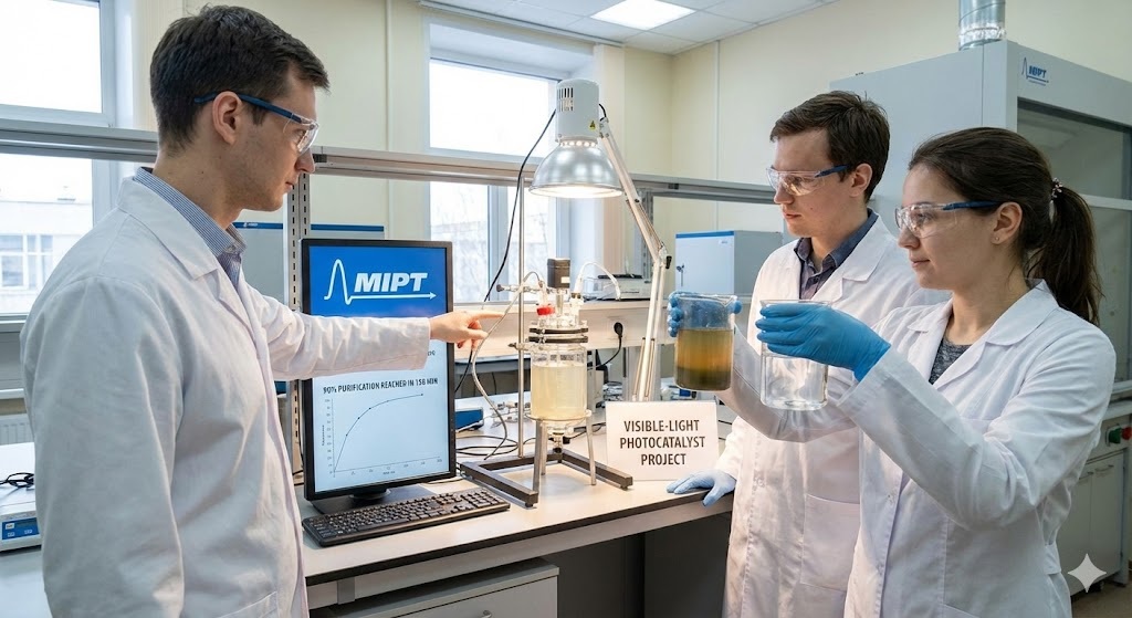
Space & Technology
MOSCOW : Researchers at the Moscow Institute of Physics and Technology have developed a new class of visible-light-activated photocatalysts capable of purifying contaminated water using natural sunlight, achieving up to 90 percent purification within 150 minutes under laboratory conditions. The work was carried out by specialists at MIPT’s Centre for Photonics and Two-Dimensional Materials in collaboration with international research partners. The study focuses on overcoming long-standing efficiency limitations in conventional photocatalytic water treatment systems, which largely depend on ultraviolet radiation. Addressing Solar Spectrum Limitations Photocatalysis is widely used to remove organic contaminants from water, including industrial dyes, agricultural pesticides, pharmaceutical residues and oil traces. In conventional systems, semiconductor photocatalysts are activated primarily by ultraviolet (UV) light. However, UV radiation accounts for only about 5 percent of the total solar spectrum reaching the Earth’s surface. Visible light, by contrast, represents approximately 50 percent of solar radiation. The limited UV fraction significantly reduces the efficiency of traditional photocatalysts when operated under natural sunlight. The MIPT research team therefore concentrated on designing materials capable of absorbing and utilizing visible light more effectively, with the aim of improving scalability and reducing energy requirements in water treatment applications. Femtosecond Laser Ablation Synthesis To engineer photocatalysts with enhanced visible-light absorption, the researchers employed femtosecond laser ablation in liquids, a synthesis technique that uses ultra-short, high-energy laser pulses. The process involves directing femtosecond laser pulses onto the surface of a solid target material submerged in liquid. The intense pulses vaporize the material at the target surface, forming a plasma plume. As the vapor cools, it condenses into nanoparticles with modified electronic and structural properties. These nanoparticles are directly dispersed in the liquid, producing stable colloidal solutions without the need for additional chemical stabilizers. According to the research team, the method is environmentally compatible because it eliminates the requirement for chemical surfactants or reducing agents typically used in nanoparticle fabrication. The technique also enables precise control over defect formation and structural characteristics that influence photocatalytic behavior. Evaluation of Niobium-Based Materials The team examined two niobium-based compounds to determine their performance under visible-light irradiation: niobium pentoxide (Nb₂O₅) and lithium niobate (LiNbO₃). Laser processing affected the structural properties of the two materials differently. In the case of Nb₂O₅, exposure to femtosecond laser pulses caused the crystalline structure to collapse, resulting in a fully amorphous material. This structural change reduced photocatalytic efficiency because the amorphous state promotes rapid recombination of photo-generated charge carriers, limiting the formation of reactive species needed for pollutant degradation. By contrast, LiNbO₃ retained its crystalline framework after laser treatment but developed controlled point defects within its structure. These defects enhanced visible-light absorption and extended the lifetime of charge carriers generated during illumination. The prolonged charge carrier lifetime increased the formation of reactive oxygen species responsible for breaking down organic pollutants in water. Laboratory Performance Results Under visible-light exposure in laboratory tests, the lithium niobate-based nanocatalyst demonstrated significantly improved degradation rates for organic dyes. The degradation rate was measured to be 2.3 times higher than that of the amorphous niobium pentoxide nanoparticles. This sustained photocatalytic activity enabled the system to achieve 90 percent purification within 150 minutes. The extended charge carrier lifetime in LiNbO₃ nanoparticles supported continuous formation of reactive species, allowing for steady decomposition of organic contaminants throughout the testing period. Future Development Plans The researchers stated that further work will focus on optimizing femtosecond laser ablation parameters to improve material performance and reproducibility. Efforts are also underway to explore scaling strategies for integrating the visible-light photocatalysts into practical water treatment systems powered by natural sunlight. The team indicated that continued refinement of the synthesis process and material engineering could support the development of energy-efficient, solar-driven purification technologies suitable for large-scale deployment.
Read More → Posted on 2026-02-21 14:36:22Search
Top Trending in 24 Hours
-
 Unitree Unveils H2-X ‘Kung Fu Legend: Guardian’ Humanoid Robot for Security and Rescue
-
 US Firm Heaviside Unveils 2.3-Kg TYR Loitering Munition With 40-Km Range at AUSA 2026
-
 Ukraine Reveals Technical Details of Russia’s New Filin Cruise Missile
-
 Iran Showcases Upgraded Arash-3 Drone with 100 kg Warhead, AI Targeting and GPS-Independent Navigation
-
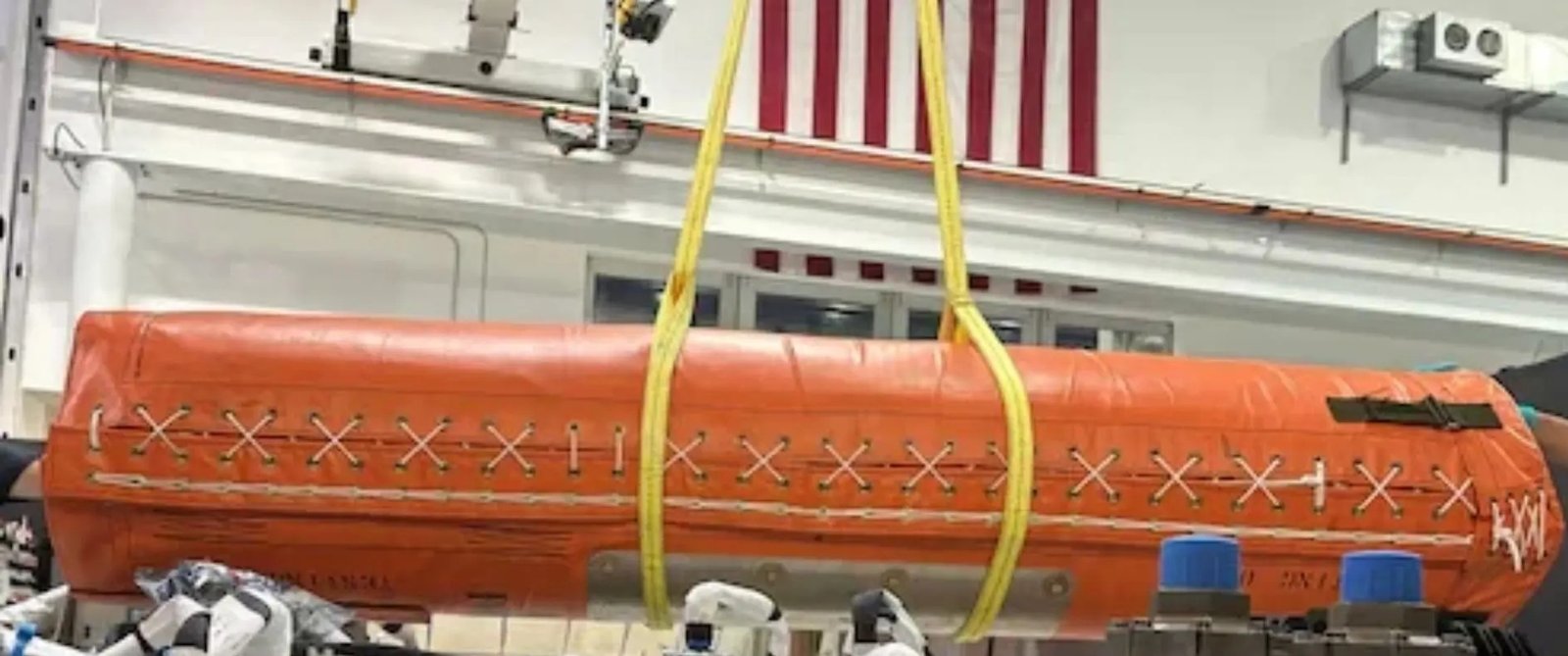 U.S. Air Force Tests SpaceX Starfall Capsule for Rapid Global Military Cargo Delivery
-
 Exail Wins Major Contract to Equip Entire Fleet of Uncrewed Surface Vessels with Marins Inertial Navigation Systems
-
 General Dynamics Unveils PERCH 2.0 Drone System for Abrams Tanks and Stryker Vehicles
-
 Voyant Demonstrates Satellite-Free Navigation Technology for UK Ministry of Defence
Top Trending in 4 Days
-
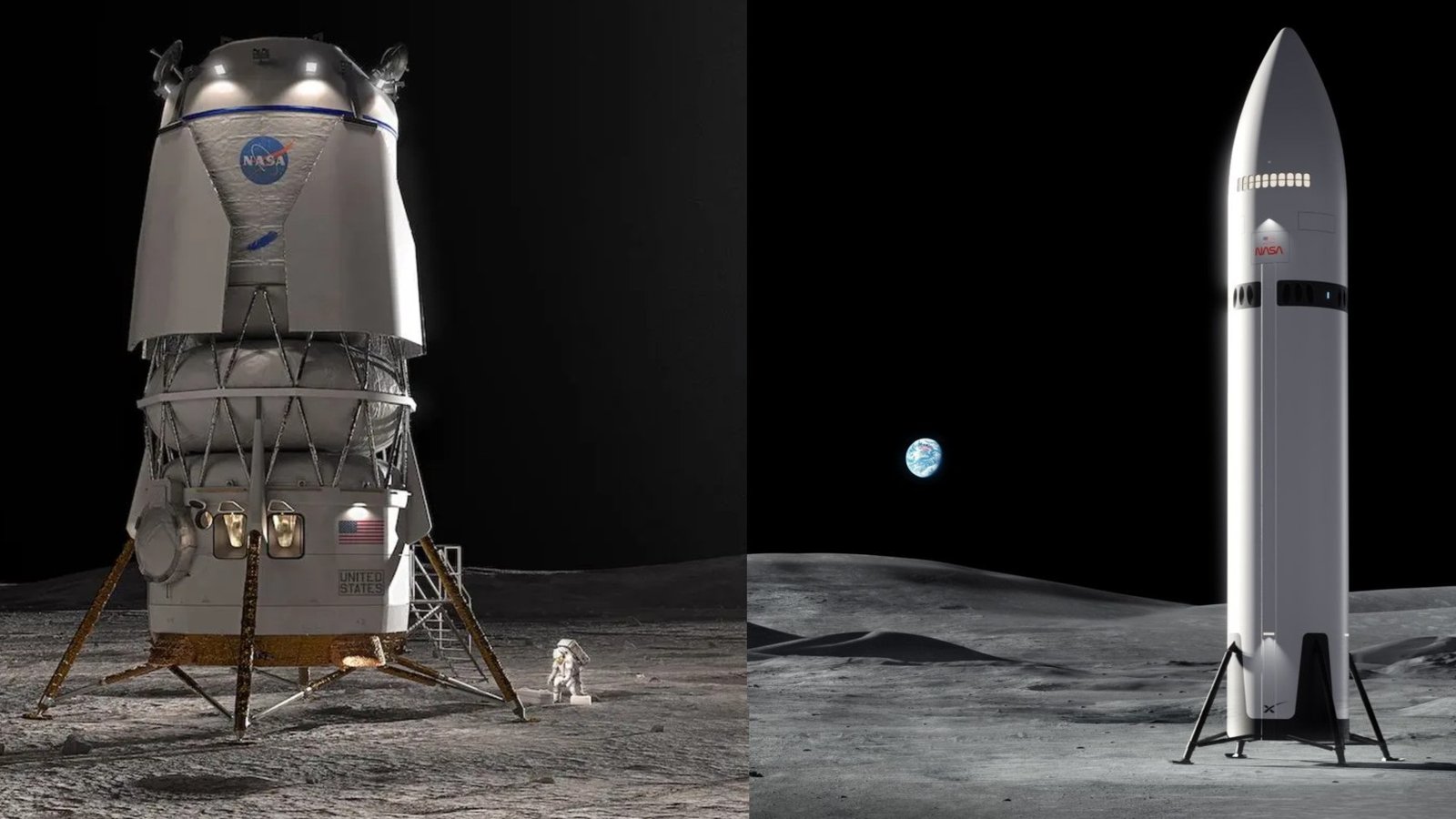 NASA Sets New Artemis Milestones as SpaceX and Blue Origin Target Moon Landings in 2027–2028
-
 US Weighs Strikes on Iran’s Kharg Island Oil Hub Ahead of Midterm Elections
-
 U.S. Air Force Awards HII Subsidiary Enlighten IT $332.8 Million Cyber Defense Contract
-
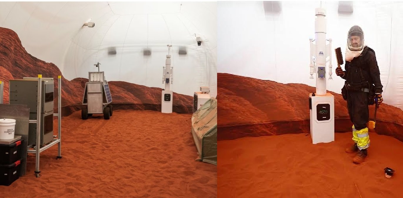 Four NASA Volunteers Mark One Year in Simulated Mars Habitat
-
 U.S. Navy Awards HII $99.1 Million Contract Modification for Zumwalt-class Destroyer USS Lyndon B. Johnson Sea Trials
-
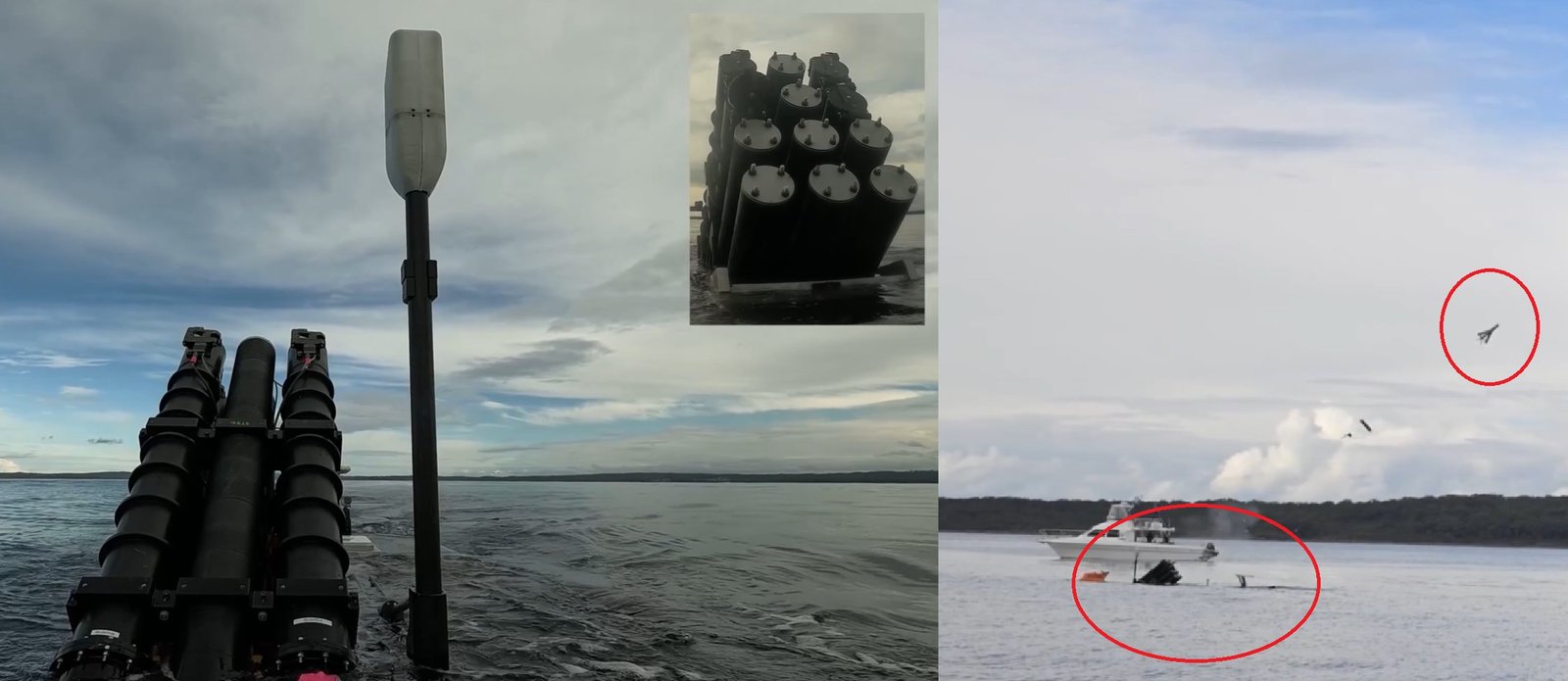 Australia Unveils Ghost Shark Autonomous Submarine’s Mine, Drone and Logistics Capabilities
-
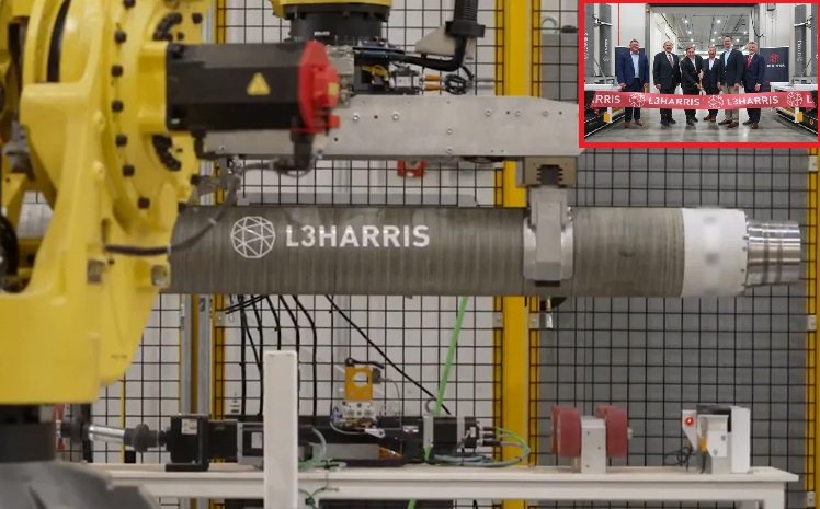 L3Harris Opens ‘Arsenal of Freedom’ Rocket Motor Plant in Arkansas to Double Production Capacity
-
 Russia Reportedly Offers Su-35 Fighters and S-400 Air Defence System to Protect Tehran