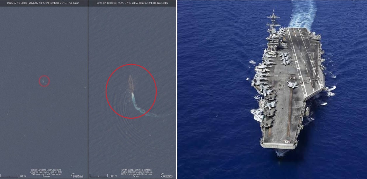
Open-source satellite imagery shared by MoloMonitor on Friday morning shows the U.S. Navy aircraft carrier USS Abraham Lincoln (CVN-72) sailing north in the Gulf of Oman, with no escort vessels visible in the immediate area of the image.
According to MoloMonitor, the carrier's approximate location was 23°00′59.7″N 60°04′07.3″E. The position places the vessel in waters where analysts note it is within range of certain Iranian coastal missile systems.
The latest imagery marks a change from earlier satellite observations. Images from July 5 had indicated that the carrier had moved into the Arabian Sea, roughly 207 kilometers south of its current reported position. The new imagery suggests the ship has since returned to the Gulf of Oman.
The USS Abraham Lincoln is a Nimitz-class nuclear-powered aircraft carrier and has been deployed in the Middle East for more than 200 consecutive days. It was redirected from the South China Sea to the U.S. Central Command (CENTCOM) area of responsibility in late January 2026. During the deployment, it has supported Operation Epic Fury and served as the flagship of Carrier Strike Group 3 (CSG-3).
The carrier is capable of displacing about 104,300 long tons, measures more than 1,090 feet (332 meters) in length, and can operate up to 90 fixed-wing and rotary-wing aircraft. It is currently embarked with Carrier Air Wing 9 (CVW-9), including F-35C Joint Strike Fighters assigned to Marine Fighter Attack Squadron 314.
The absence of escort ships in the satellite image has drawn attention because U.S. Navy aircraft carriers typically operate as part of a carrier strike group that includes guided-missile destroyers and other support vessels. However, satellite imagery provides only a snapshot of a specific location and time, and escort ships may be operating beyond the captured frame or at a greater distance.
The U.S. Navy has not issued an official statement regarding the carrier's precise location or its current escort configuration.
——— End of Article ———