LONDON, — British technology company Voyant has demonstrated its navigation software to the UK Ministry of Defence (MOD), showing how autonomous maritime vessels can navigate without relying on satellite signals such as GPS. The trial took place on October 5, 2026, aboard a Kraken K3 Scout autonomous surface vessel in the coastal waters of the Solent, off southern England.
The demonstration is part of a wider MOD programme to develop resilient Position, Navigation and Timing (PNT) capabilities for military operations in environments where satellite signals are disrupted or unavailable.
How the Technology Works
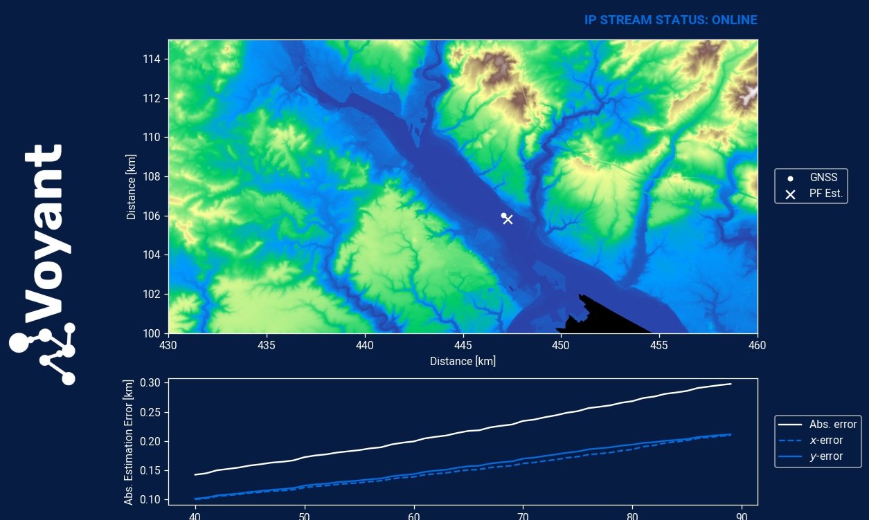
Voyant’s software uses sensor fusion and probabilistic particle filter algorithms to compare real-time radar imagery with pre-loaded reference maps of surrounding terrain. By matching radar observations with known geographic features, the system estimates the vessel’s position without relying on Global Navigation Satellite Systems (GNSS).
It also provides a real-time estimate of positioning uncertainty, helping operators assess the reliability of location data. The software is designed to work with existing sensors, avoiding the need for additional hardware.
The technology could allow uncrewed vessels to continue missions and return safely when satellite navigation is lost or deliberately disrupted through jamming or spoofing.
Importance for Maritime Defence
Military ships, aircraft, missiles and drones rely on GNSS for positioning, navigation and timing. However, satellite signals can be disrupted by electronic interference. Coastal terrain and dense infrastructure can also reduce reception, making alternative navigation methods particularly important in littoral environments.
The demonstration comes amid concerns about GNSS interference affecting military and commercial shipping, including in the Baltic Sea, Black Sea and Middle East. The UK Maritime and Coastguard Agency has also issued guidance on operating in GNSS-denied and degraded environments.
Voyant and Kraken K3 Scout
James Norwood, CEO of Voyant, said reliable navigation remained fundamental to maritime operations as access to GNSS could no longer be assumed. He said the demonstration with Kraken and the MOD showed a practical capability to support the safe and effective deployment of autonomous maritime systems in challenging conditions.
Norwood added that the trial represented another milestone in the UK’s investment in sovereign technologies to strengthen resilience, improve operational freedom and support future autonomous defence capabilities.
Voyant, a University of Liverpool spin-out, develops sensor-fusion and tracking software. The Kraken K3 Scout, built by British company Kraken Technology, is an 8.5-metre uncrewed surface vessel capable of speeds approaching 55 knots.
The successful trial demonstrates the potential of radar-based navigation when satellite signals are unavailable. However, it does not by itself confirm that the technology has entered operational military service.
——— End of Article ———