AMMAN, Jordan — Newly released commercial satellite imagery has provided a clearer picture of the damage at Jordan's Muwaffaq al-Salti Air Base, indicating that the Iranian missile strike caused more extensive damage than initially reported.
🚨Satellite imagery gives us a better look of the full damage at Muwaffaq al-Salti Air Base, Jordan.
— Soar (@SoarAtlas) July 20, 2026
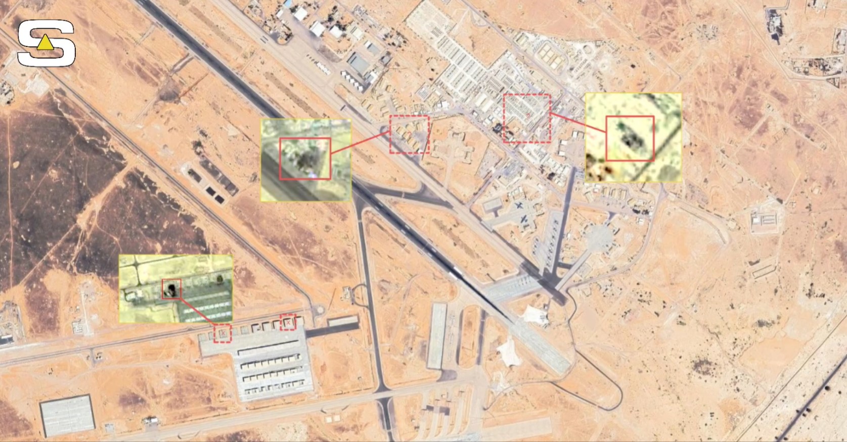
Low-res previews from July 19 (SV NEO-1) show the base was hit again. Two hangars struck, a major impact is visible in the housing area, and multiple shelters were destroyed. pic.twitter.com/vNZ9Z1M1Ju
Satellite imagery published by Solar Atlas and captured by the SV NEO-1 commercial satellite on July 19 shows multiple impact sites across the air base, including aircraft hangars, drone facilities and troop housing. The imagery provides one of the clearest publicly available views of the strike and its effects on the installation.
Satellite Imagery Shows Multiple Impact Areas
The July 19 imagery shows that the base was struck in several locations. At least two aircraft hangars were hit, while multiple aircraft and drone shelters across the installation appear to have been destroyed. The imagery also shows a major impact in the U.S. troop housing area, where American service members were killed during the attack.
🛰 Significantly more damage is visible at Muwaffaq al-Salti Air Base in Jordan.
— Egypt's Intel Observer (@EGYOSINT) July 20, 2026
The base was not struck by a single missile but by what appears to have been a large, highly accurate salvo.
Another hangar on the ISR/CAS apron was hit, while a major impact is visible in the… https://t.co/d7wUGImjxL pic.twitter.com/QM5U6LnHjV
Independent open-source intelligence group Egypt's Intel Observer (EGYOSINT), which reviewed the imagery, assessed that the pattern of impacts indicates the base was struck by what appears to have been a large, highly accurate missile salvo rather than a single missile.
According to the group, another hangar on the base's Intelligence, Surveillance and Reconnaissance/Close Air Support (ISR/CAS) apron was also hit, suggesting multiple operational areas were targeted during the strike.
Drone Hangars Sustain Heavy Damage
EGYOSINT's assessment identified extensive damage around 31°49'53"N, 36°47'29"E, where three drone hangars previously associated with U.S. MQ-9 Reaper operations appear to have been heavily damaged or destroyed.
🛰 🇯🇴🇺🇸 Before-and-after GIF of Iranian satellite imagery provides a closer look at the extensive damage to three drone hangars (31°49'53"N, 36°47'29"E) at Muwaffaq al-Salti AB.
— Egypt's Intel Observer (@EGYOSINT) July 20, 2026
At least one U.S. MQ-9 Reaper drone also appears to have been damaged by missile shrapnel. https://t.co/dIvYfKxc4Q pic.twitter.com/nzmQvr4CsM
The imagery also indicates that at least one U.S. MQ-9 Reaper drone appears to have sustained missile shrapnel damage. The assessment is based on commercially available satellite imagery and remains part of ongoing open-source analysis.
Earlier commercial satellite imagery captured around July 10 had already shown damage to newly constructed hangars within the U.S.-operated section of the base. The latest imagery provides a more complete assessment of the strike's impact across the installation.
U.S. Casualties Confirmed
The satellite imagery also shows severe damage in the troop housing area, consistent with official casualty reports released after the attack.
According to U.S. Central Command (CENTCOM), Iranian ballistic missiles and drones targeted Muwaffaq al-Salti Air Base on July 17. The attack killed two U.S. service members, while another service member was initially reported missing. Four additional U.S. personnel were injured and later discharged from Jordanian hospitals after receiving treatment. U.S. officials also confirmed that unidentified remains were recovered from the site.
Strategic Role of Muwaffaq al-Salti Air Base
Located approximately 100 kilometers east of Amman, Muwaffaq al-Salti Air Base serves as a key hub for U.S. and coalition air operations in the Middle East.
The base supports intelligence, surveillance and reconnaissance missions, drone operations, logistics and fighter aircraft deployments, including MQ-9 Reaper drones and aircraft such as the F-15E Strike Eagle and F-16 Fighting Falcon.
Iranian Claims and Ongoing Assessment
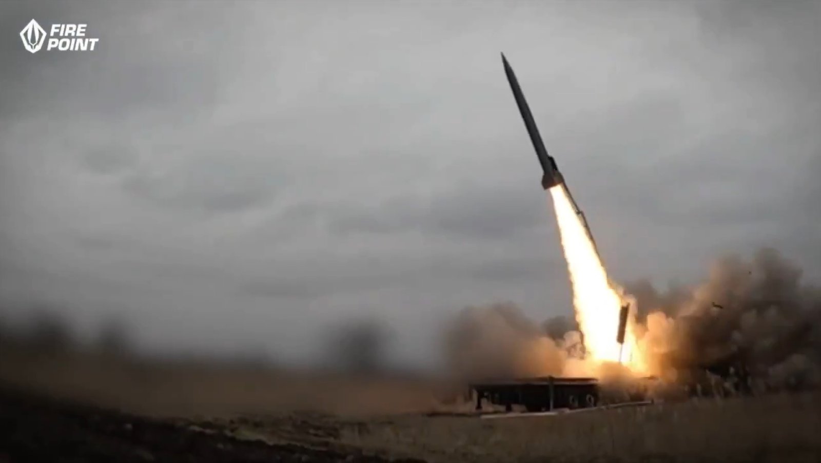
The Islamic Revolutionary Guard Corps (IRGC) claimed responsibility for the strike, stating that it used precision ballistic missiles, including the Khyber-Shakan, to target U.S. command-and-control facilities and aircraft storage areas.
Jordanian authorities initially reported that air defense systems intercepted several incoming missiles. However, the latest commercial satellite imagery published by Solar Atlas, together with independent analysis by EGYOSINT, indicates that multiple projectiles reached the base and struck military infrastructure.
Open-source analysts continue to examine newly available imagery to determine the full extent of the damage. Additional high-resolution commercial satellite imagery may provide further confirmation of damaged facilities and equipment.
As of July 20, 2026, assessments remain ongoing. The latest satellite imagery provides the clearest publicly available visual evidence of the strike, allowing independent observers to compare the physical damage with official statements and better understand the impact on one of the region's most important U.S.-supported air bases.
——— End of Article ———