MOSCOW, Russia — Russian engineers have completed research and development of an autonomous navigation system for unmanned aerial vehicles (UAVs) that allows drones to determine their position using onboard cameras instead of satellite navigation or radio signals.
The system was developed by Ploshchad, a resident of the Center for Unmanned Systems and Technologies (CBST), and Russian developers have already begun equipping drones with the technology, according to reporting by Izvestia published on August 17, 2026.
How the Visual Navigation System Works
The technology uses visual odometry, machine vision and a neural network to determine the drone's position.
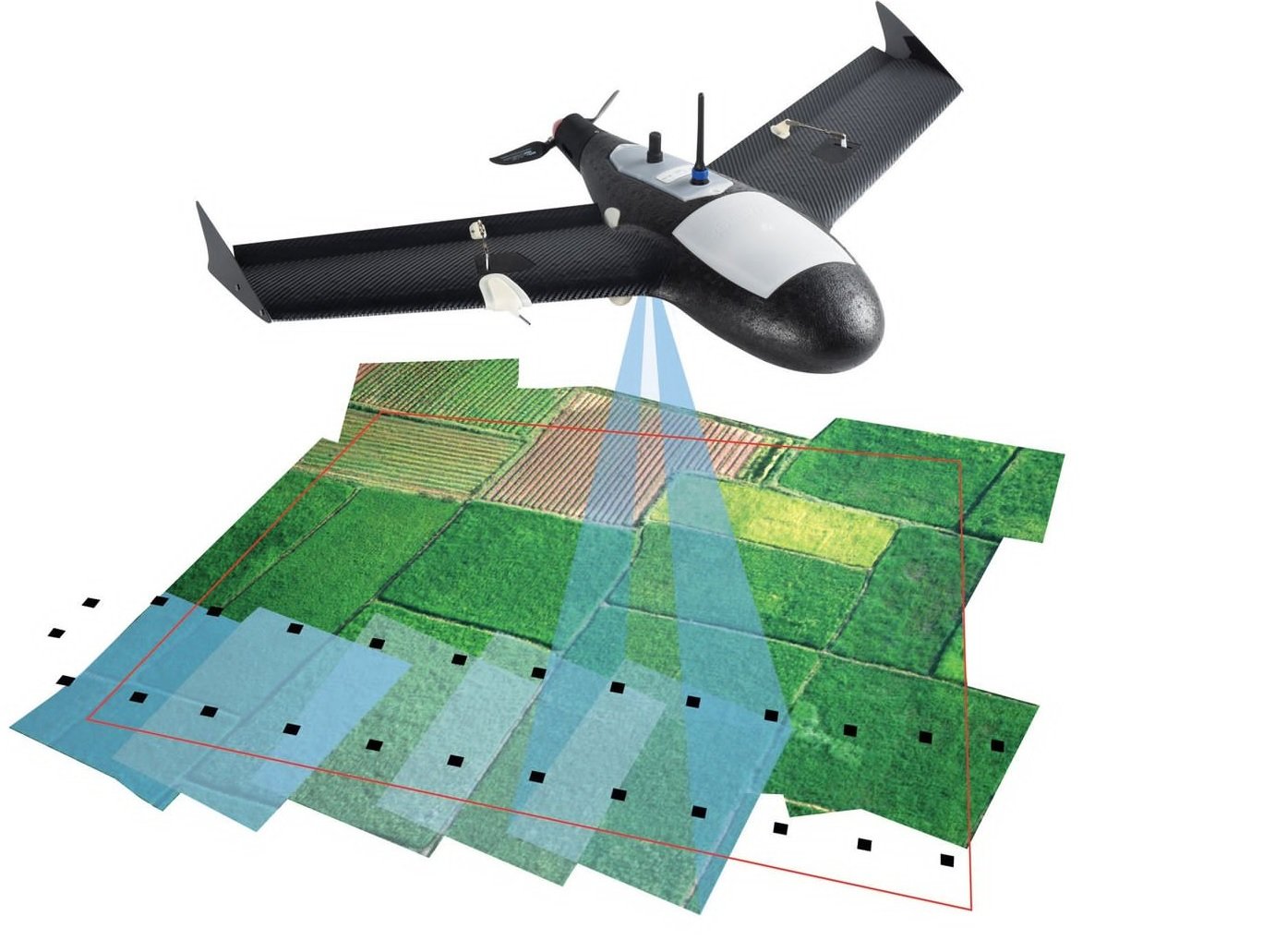
During flight, cameras mounted on the drone continuously observe the terrain below. The onboard neural network processes the video in real time and compares visible terrain features with a digital map stored in the drone before the flight. The reference map can be based on satellite imagery or aerial photography.
By matching the terrain seen by the cameras with the stored imagery, the system calculates and continuously updates the drone's position.
The approach also addresses the gradual accumulation of errors associated with conventional inertial navigation. According to the developers, continuous comparison with the terrain allows the system to correct such deviations during flight.
The neural network can also identify a designated object by comparing what it sees with a predefined digital template.
Why It Is Called "Martian" Navigation
The approach is sometimes referred to as "Martian" technology because of its similarity to the navigation principle used by NASA's Ingenuity helicopter on Mars.
Ingenuity operated without access to GPS. Its downward-facing cameras observed the Martian surface and used changes in visible terrain features to estimate movement. Communication with Earth also involved significant delays, making direct real-time control impractical.
After the Ingenuity mission ended in 2024, related designs and code were made publicly available, contributing to wider interest in visual-odometry methods for terrestrial autonomous systems.
The Russian system applies the same general principle to drones operating on Earth, but uses a pre-loaded digital map to match the terrain observed by the aircraft.
Resistance to Electronic Warfare
One of the main advantages of the system is that it does not require GPS or GLONASS signals, a radio link or continuous operator control for navigation.
Military expert Yuri Lyamin told Izvestia that this makes the system resistant to electronic-warfare methods that interfere with satellite-navigation signals. Satellite navigation can be jammed or spoofed in areas where electronic warfare is active, while a navigation system based on onboard optical processing does not depend on those external signals.
The system can also operate without antennas required for satellite-navigation reception or radio-based control, according to the reporting.
The use of standard optical cameras is another factor highlighted by the developers. The technology does not require expensive specialized optical sensors, which can reduce the cost of adapting drones for visual navigation.
Development Challenges
Visual navigation is not a new concept. According to Dmitry Kuzyakin, chief designer of the Center for Integrated Unmanned Solutions, the basic approach has been known for more than a decade.
The difficulty has been developing recognition algorithms capable of reliably processing terrain and objects during longer flights. Simpler optical-flow systems can track movement but have limitations in altitude and range, according to Kuzyakin.
Izvestia reported that U.S. company Skydio had previously made significant progress with similar visual-odometry technology, including applications involving military drones. Russian developers now say they have demonstrated the technological capability to apply the approach to longer-range UAVs.
Kuzyakin said the next important step is moving from development and demonstrated systems to mass production and delivery to operational units.
Weather and Nighttime Limitations
The system remains dependent on the ability of its cameras to obtain useful visual information.
Its performance can decrease in dense cloud cover, heavy fog and precipitation. Night operations can also create difficulties because reduced visibility and contrast make it harder for optical systems to identify and match terrain features.
These limitations mean that visual navigation does not eliminate the need to consider environmental conditions when operating autonomous drones.
Potential Civilian Applications
The technology is not limited to military UAVs.
Optical navigation can also be used in commercial drone logistics, courier delivery and agricultural applications. These sectors can benefit from autonomous positioning systems that do not depend entirely on continuous satellite-navigation coverage.
The ability to identify locations and objects through onboard cameras and machine-learning algorithms could also support autonomous operations in areas where satellite or communications signals are unavailable or unreliable.
Part of Russia's Wider UAV Development
The introduction of the visual-navigation system comes as Russia continues developing autonomous unmanned systems and other robotic technologies.
The Russian Ministry of Defense has recently showcased various robotic complexes, drones and electronic-warfare equipment. These developments have included the AI-equipped "Skvorets-Intercessor" interceptor drone, reported to have a maximum speed of up to 350 km/h, an upgraded "Fir Tree" UAV equipped with a warhead, and new ammunition designed for Molniya-2 drones.
The camera-based navigation system represents another effort to increase the autonomy of UAVs by reducing their dependence on satellite navigation, radio communications and continuous operator control.
The information on the navigation system is primarily based on Izvestia's August 17, 2026 report, with the technical details provided in related Russian reporting on the development.
——— End of Article ———