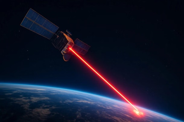
Kuva Space Successfully Launches Hyperfield-1 Hyperspectral Microsatellite, Pioneering AI-Powered Earth Observation
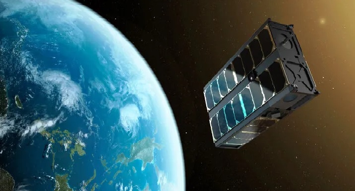
Finnish company Kuva Space has taken a significant step forward in its mission to improve Earth’s sustainability with the successful launch of its first commercial hyperspectral microsatellite, Hyperfield-1. The satellite was launched aboard SpaceX’s Falcon 9 smallsat rideshare mission from Vandenberg Space Force Base in California. The company confirmed that first contact with the satellite has been made, marking a critical milestone in its ambitious plan to build a large constellation aimed at daily and gapless subdaily global monitoring.
Hyperfield-1: A Game-Changer in Hyperspectral Imaging
Hyperfield-1 is a commercial microsatellite designed to deliver advanced hyperspectral imaging capabilities, providing unique insights through a patented hyperspectral camera. This camera distinguishes Earth’s materials and environmental conditions by analyzing their distinct spectral signatures. The satellite’s data is processed through Kuva Space’s AI-powered analytics platform, automatically converting raw hyperspectral data into decision-ready insights within just 15 minutes.
The platform’s capabilities include monitoring and identifying crop species, growth stages, biomass health, forecasting yields, analyzing water quality, detecting illegal maritime activities, and assessing biodiversity. By offering near real-time, cost-effective insights, Kuva Space aims to revolutionize how organizations use spaceborne data to make informed decisions across industries such as agriculture, aquaculture, and environmental management.
Kuva Space’s Vision: AI-Driven Insights-as-a-Service
Unlike traditional pay-per-use models for satellite data, Kuva Space offers an insights-as-a-service subscription model. The company’s vision is to make spaceborne solutions accessible to organizations beyond the space industry, helping them to implement effective ESG strategies, enhance security, and optimize resource management. The automated AI-driven platform eliminates the high costs and accessibility challenges that have traditionally limited the use of satellite data.
Kuva Space’s Hyperfield constellation is designed for flexibility, offering customizable in-orbit tuning to meet the specific needs of different industries. The company plans to scale up rapidly, aiming to deploy 100 satellites by 2030 to achieve continuous global monitoring.
Future Developments and Innovations
Hyperfield-1 is the first step in Kuva Space’s larger vision. The company collaborated with the VTT Technical Research Centre of Finland to co-develop the satellite’s camera technology. The second satellite, Hyperfield-1B, is scheduled for deployment in early 2025 under the European Space Agency’s InCubed program. This second generation of satellites will feature enhanced specifications, including in-orbit edge computing and satellite-to-satellite communication to improve processing efficiency and reduce latency for delivering insights.
Kuva Space is currently offering early access to a select group of customers, particularly those in agriculture and aquaculture, to test and refine the service. The company invites businesses and public organizations to sign up and explore how hyperspectral data can enhance their operations and resilience.
Conclusion: A Leap Toward Sustainable Earth Monitoring
The successful launch of Hyperfield-1 is a landmark moment for Kuva Space as it continues to push the boundaries of satellite technology and AI-powered analytics. By integrating cutting-edge hyperspectral imaging with automated AI processing, the company is set to provide industries worldwide with accessible, timely, and precise insights, ultimately contributing to better resource management and climate resilience.
As Kuva Space moves forward with its constellation plans, its unique approach to gapless monitoring and rapid data processing could set new standards in Earth observation, making advanced spaceborne insights a practical tool for everyday decision-making across industries.
✍️ This article is written by the team of The Defense News.