Iran To Launch Three Imaging Satellites In Late December To Boost Disaster Response And Resource Management

Iran is preparing to launch three domestically developed satellites—Paya, Zafar-2 and Kowsar—into low Earth orbit in late December, marking a significant step in the country’s expanding space programme. Iranian officials say the mission is focused on civilian applications, particularly natural-resource management, environmental monitoring and disaster response, as the country faces increasing challenges from droughts, floods and environmental degradation.
According to official statements, the satellites are equipped with advanced imaging and data-collection technologies designed to enhance Earth observation capabilities. The spacecraft are expected to be placed in an orbit of roughly 500 kilometres above Earth, a standard altitude for remote-sensing missions that balances wide coverage with operational efficiency.
Focus On Natural Resources And Crisis Management
Iranian authorities describe the launch as part of a broader effort to integrate space-based data into national planning and development. Satellite imagery is expected to support agriculture, helping monitor crop health, soil moisture and irrigation patterns, while also assisting in water-resource management during prolonged dry periods.
Disaster management is another central objective. Officials say the satellites will enable faster damage assessment following floods, earthquakes, landslides and forest fires, allowing emergency agencies to respond more effectively. Environmental monitoring, including tracking desertification, deforestation, air pollution and urban expansion, is also highlighted as a key benefit of the mission.
Capabilities Of Paya, Zafar-2 And Kowsar
Paya, described as the most advanced of the three, is an Earth-observation satellite weighing around 150 kilograms. Iranian sources say it can capture black-and-white images with approximately five-metre resolution and colour images at around ten metres, making it suitable for large-scale mapping, agricultural analysis and disaster assessment.
Zafar-2 is an upgraded version of earlier Zafar-class satellites developed by Iran’s academic and research institutions. It combines imaging and improved communication capabilities, allowing more efficient transmission of data to ground stations. While not designed for very high-resolution imagery, it is optimized for wide-area monitoring and civilian scientific use.
Kowsar represents a newer generation of remote-sensing satellites and is reported to include elements of data relay and connectivity. Iranian media have linked it to applications such as smart agriculture and environmental sensing, where satellite imagery is combined with ground-based sensor data to improve monitoring and analysis.
Launch Vehicle And International Cooperation
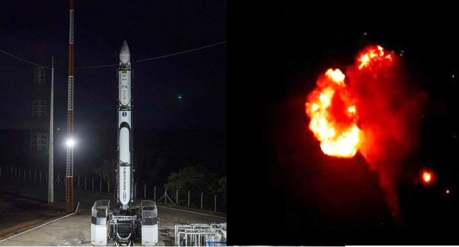
The satellites are expected to be launched aboard a Russian Soyuz rocket from a Russian spaceport, reflecting Iran’s continued space cooperation with Moscow. While Iran has developed indigenous launch vehicles, it has increasingly relied on foreign rockets to place heavier or more complex payloads into orbit, particularly for multi-satellite missions.
This cooperation highlights Iran’s pragmatic approach to space access, using established launch systems while continuing to develop domestic capabilities.
Military Implications And Dual-Use Concerns
Despite official emphasis on civilian objectives, Iran’s space launches continue to draw international scrutiny due to potential military implications. The satellites themselves are not weapons, but Earth-observation technology is inherently dual-use. Even medium-resolution imagery can support military planning, including infrastructure mapping, monitoring large facilities, assessing damage after strikes and improving logistics.
Similarly, the launch rockets rely on technologies—such as multi-stage propulsion, guidance systems and high-energy flight profiles—that overlap with those used in long-range ballistic missiles. This technological overlap is a key reason why Iran’s space activities are closely watched by Western governments.
However, analysts note that the reported imaging resolutions of Paya and Zafar-2 are generally insufficient for precision targeting on their own and are more suited to environmental monitoring and broad situational awareness.
A Milestone In Iran’s Space Programme
If successful, the late-December launch will add three new satellites to Iran’s growing orbital fleet and strengthen the use of space-based data in domestic planning and crisis response. At the same time, it underscores the continuing debate over the dual-use nature of space technology, as Iran seeks to present its programme as scientific and economic while international concerns over security implications persist.
✍️ This article is written by the team of The Defense News.