ISRO–NASA NISAR Unfurls World’s Largest 12-Meter Radar Antenna in Space

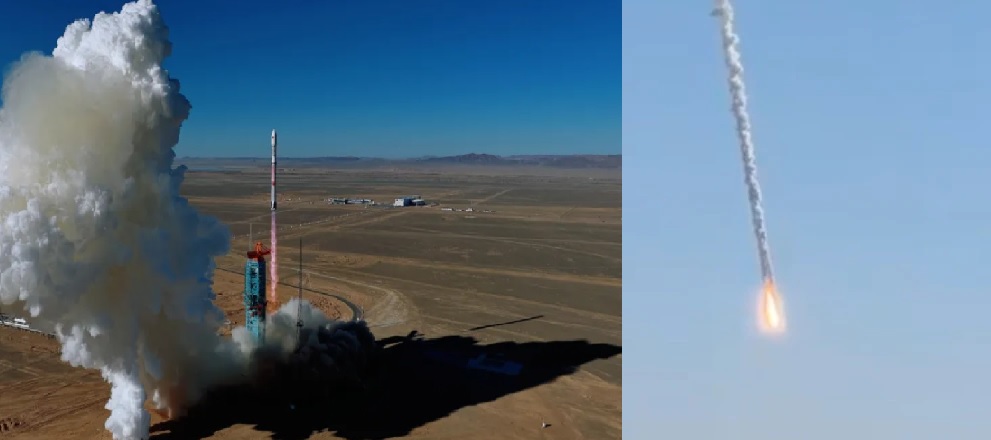
Sriharikota/Pasadena, August 15, 2025 — In a historic milestone for space cooperation, ISRO and NASA have successfully deployed the world’s largest spaceborne radar antenna on the NISAR satellite, just 17 days after its launch from India’s Satish Dhawan Space Centre on July 30.
The 12-meter gold-plated radar reflector antenna, attached to a 9-meter boom, was unfurled in orbit in 37 minutes using explosive bolts and motors. Weighing around 64 kilograms and built with 123 composite struts, the reflector expanded into position smoothly, marking one of the most critical steps of the mission’s 90-day commissioning phase.
About the Mission
The 2,393-kg NISAR spacecraft, powered by nearly 6,500 watts of solar energy, circles Earth in a 747 km sun-synchronous orbit. It carries both L-band and S-band synthetic aperture radars, which together will map the entire Earth every 12 days with unmatched precision. The L-band radar has a wavelength of about 24 cm, while the S-band radar has about 10–12 cm, enabling the mission to capture subtle ground deformations, vegetation changes, and ice movements.
Unlike traditional optical satellites, NISAR can observe day or night and through clouds, making it invaluable for continuous monitoring of Earth’s surface.
What It Will Do
NISAR is designed to monitor:
-
Ecosystem changes such as deforestation, soil health, and agricultural cycles
-
Ice sheets and glaciers, measuring their melt and contribution to sea-level rise
-
Natural hazards like earthquakes, landslides, volcanic activity, and floods
-
Ground subsidence and infrastructure stability in urban areas
The satellite’s radar interferometry technology will detect movements of just a few millimeters, providing early warning insights. Importantly, the mission will provide freely available data, with regular products released within one to two days, and in emergencies, within hours.
Significance and Scale
NISAR is a $1.3 billion collaboration, one of the largest joint Earth science efforts between India and the United States. NASA contributed the L-band radar, high-speed communication systems, and navigation payloads, while ISRO provided the S-band radar, satellite bus, launcher, and will oversee operations.
The mission aims for a minimum lifespan of five years, although consumables may allow operations beyond that. By fall 2025, once all systems are tested and calibrated, NISAR will officially begin science operations, creating the most detailed global radar maps of Earth ever attempted.
Why It Matters
The successful antenna deployment confirms NISAR’s capability to become the world’s most advanced radar imaging satellite, a tool that will support climate research, disaster response, water and forest management, and agricultural planning. Scientists and emergency responders alike are hailing it as a game-changer for real-time environmental intelligence.
✍️ This article is written by the team of The Defense News.